ENVIRONMENTAL SCIENCE · CHAPTER 6
Two Numbers Make a Biome
Follow along with your worksheet, one question at a time.
mrsajdak.com/biomes
Photo: King of Hearts, CC BY-SA 4.0
START HERE · PICK AN OPENER
Choose how to open the lesson
Click a card to jump to it. Every option ends at the same Observe, Wonder, Predict slide and the same driving question.
OPTION A · VIDEO
Over the Mountains
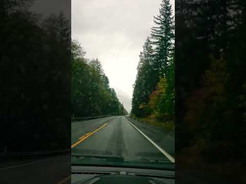
Clip 1 is a drive across Washington State, sped up: from Packwood, over White Pass, down to Yakima. Clip 2 is the top of a ridge in the Olympic Mountains. Clip 3 is the Hoh Rain Forest.
Watch for
What is the weather at the start of the drive? At the end?
Watch the trees. When do they change?
On the ridge: what is on each side of the mountain?
Videos on YouTube: Patrick Budde; ExploreOlympics.com; National Geographic.
OPTION B · TRY IT · 4 MINUTES
Cold Can, Warm Can
1
Set two cans or bottles on a desk: one straight from ice water or the fridge, one at room temperature.
2
Dry both with a paper towel. Wait one minute.
3
Breathe slowly on each one from close up.
4
Run a finger down each one. Which is wet?
You need
Two cans or bottles that match
Ice water or a fridge (20 minutes ahead)
A paper towel
Watch for
Water appears on only one can.
Nobody poured any water on it. Where did it come from?
What is different about the air right next to that can?
OPTION C · PHOTOS
Phenomenon: Two Trails, One State
Photos: King of Hearts, CC BY-SA 4.0 · BLM Oregon and Washington, public domain
START HERE
Observe, wonder, predict
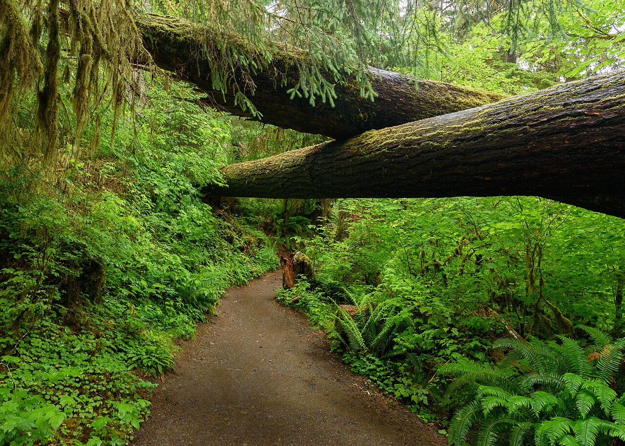
Two places in Washington State, about 200 miles apart. They are almost the same distance from the equator, and they have almost the same temperature for the year. One is a forest of giant, mossy trees. The other is dry and bare.
OBSERVEWhat differences did you notice between the two places?
WONDERWhat do you wonder about the weather in each place?
PREDICTWhat one thing could make one place a forest and the other so dry? Explain your reasoning.
Photo A, up close.
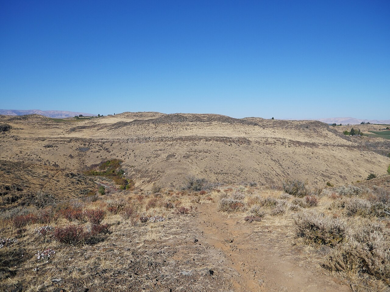
Photo B, up close.
Photos: King of Hearts, CC BY-SA 4.0 · BLM Oregon and Washington, public domain
DRIVING QUESTION
How can two numbers tell you what grows in a place?
START HERE
Where Are These Trails?
Finished observing? Click here to find out.
Photo A is the Hoh Rain Forest, near the town of Forks, Washington, close to the Pacific Ocean. Photo B is Cowiche Canyon, near the city of Yakima, Washington, on the other side of the mountains. The two towns are almost the same latitude, and their average temperatures for the year are only 1°F apart.
Watched the video or tried it? Click here.
The drive starts in the rainy forest near Packwood, Washington, on the wet side of the Cascade Mountains, and ends in Yakima on the dry side. The cold can got wet because air right next to it cooled down. Nobody poured water on it.
Today, you will place ten real climate cards on a grid and find the groups. You will see which plants grow in each group. You will follow air over the equator and over a mountain. Then you will place Buffalo and a mystery city. At the end, you will return to the driving question.
BEFORE YOU START
Two numbers on every card
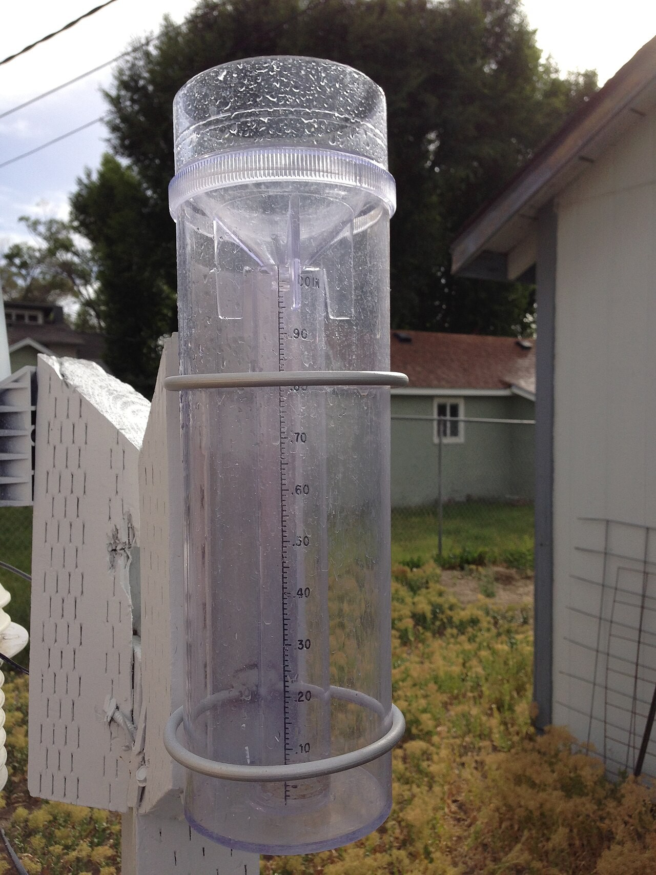
A rain gauge. Melted snow counts too.
Words for this lab
The year average is a place's temperature averaged over the whole year, in °F.
Rain and snow in a year is all the water that falls in a year, in inches.
Latitude is how far a place is from the equator. Buffalo is at 43° N.
Every card is real: the averages from 30 years of weather, 1991 to 2020.
Is it the temperature or the rain and snow that makes the two trails so different?
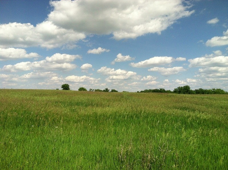
Photo: Famartin, CC BY-SA 3.0
BEFORE YOU START
What you will learn
I can place real climate data on a grid and find the groups.
I can explain how temperature and precipitation decide which biome grows.
I can explain why rainforests and deserts are where they are.
BEFORE YOU START
Get set up
1
Open mrsajdak.com/biomes on your device.
2
Write your name, the date and your period on the worksheet.
3
Find the four tabs at the top of the lab. Each tab goes with one part of the worksheet.
4
Start on Tab 1. Do not skip ahead.

| Tab in the lab | Worksheet | Questions |
|---|---|---|
| 1. The card sort | Part 1 | 1 to 5 |
| 2. The biome map | Part 2 | 6 to 9 |
| 3. Rising air, rain shadows | Part 3 | 10 to 13 |
| 4. Buffalo and city L | Part 4 and Wrap it up | 14 to 18 |
Screenshot: mrsajdak.com/biomes
TAB 1 · QUESTIONS 1 TO 5
Part 1. The card sort
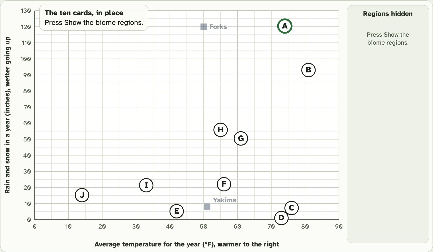
Every card is a real place. You do not know where yet.
Put each card on the grid by its two numbers. Then look for neighbors.
Photo: QKC, CC BY-SA 3.0
PART 1 · QUESTIONS 1 AND 2
Two towns on the grid
1
Press Put Forks on the grid.
2
Press Put Yakima on the grid.
3
Copy both towns from the table into Question 1.
4
Which number is very different? Tick it in Question 2.
PART 1 · TAB 1
Read a climate card
1
The big letter names the card.
2
The first number is the year average, in °F.
3
The second number is the rain and snow in a year, in inches.
4
Under the grid, the bars show rain and snow each month. The line with dots shows the temperature each month.
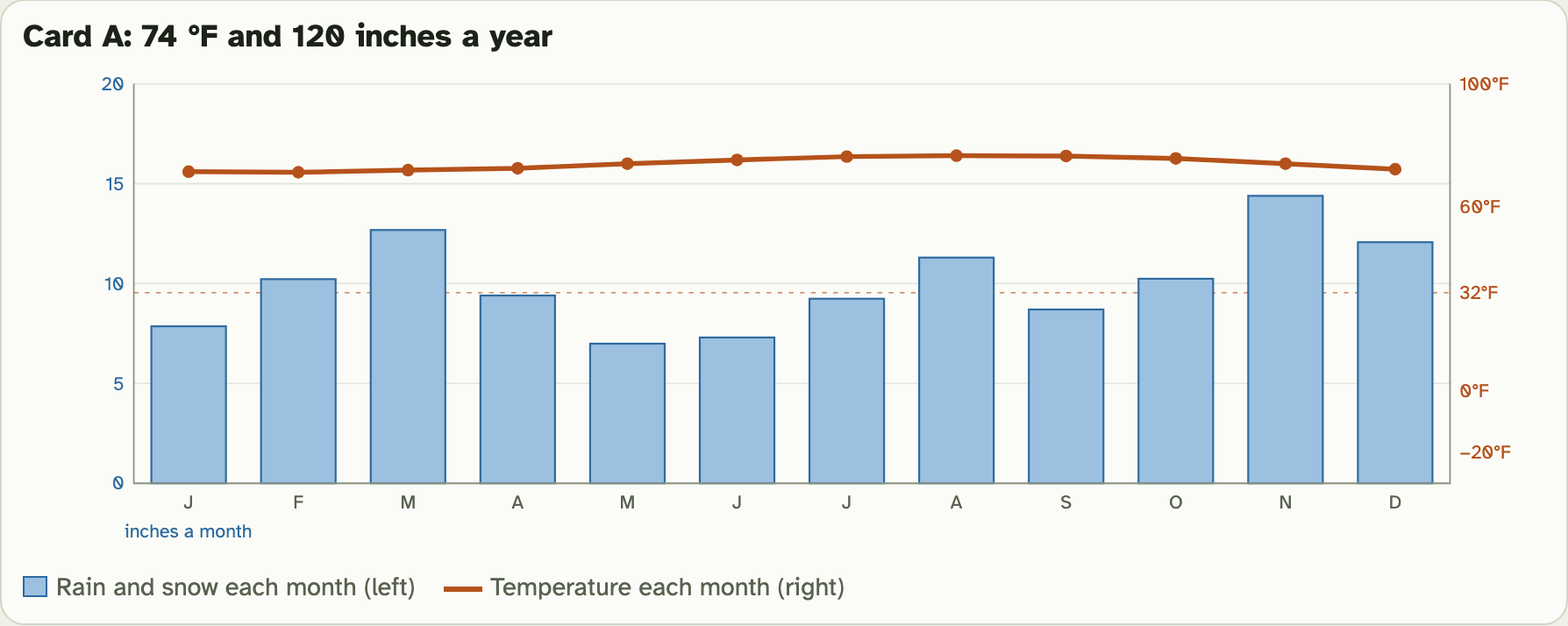
This is card A. Pick any card to see its graph.
Screenshot: mrsajdak.com/biomes, Tab 1
PART 1 · TAB 1
Place cards A to J
1
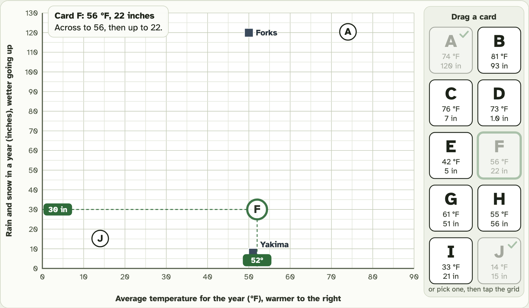
Drag a card from the right side onto the grid.
2
Go across the bottom to its temperature.
3
Then go up to its rain and snow. Let go.
4
Or: pick a letter, then tap its spot on the grid.
Example
A card says 30 °F and 12 inches.
Across to 30, up to 12
These are not your numbers. Use your own.
Screenshot: mrsajdak.com/biomes, Tab 1
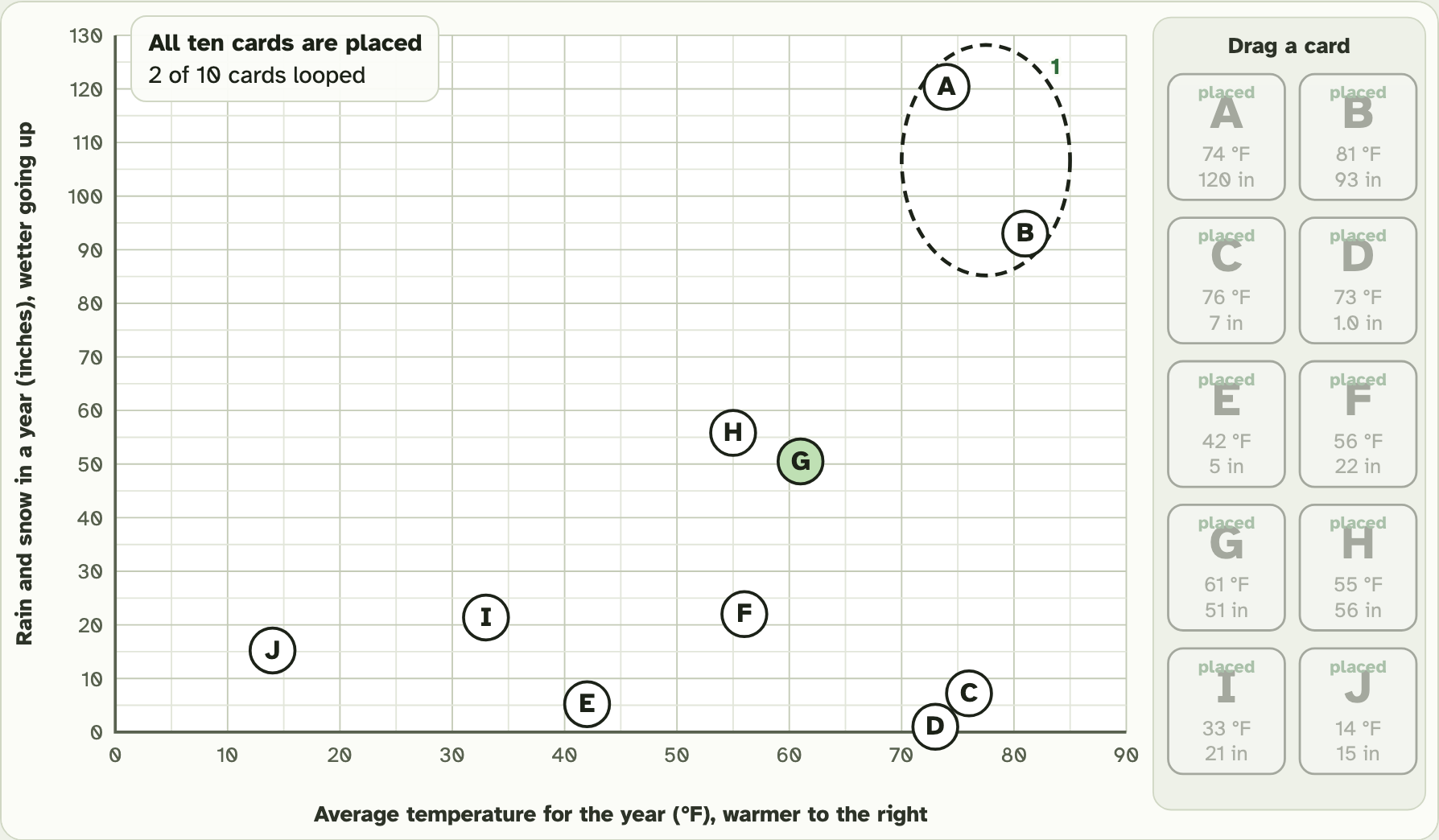
PART 1 · QUESTION 3
Loop the cards that land together
1
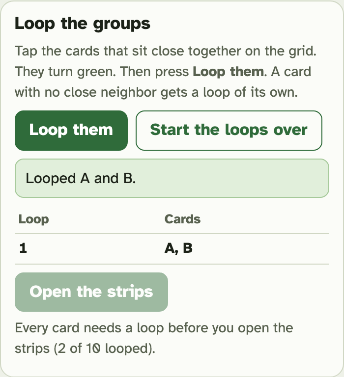
Tap the cards that sit close together. They turn green.
2
Press Loop them.
3
A card with no close neighbor gets a loop of its own.
4
Write each loop in Question 3.
Screenshot: mrsajdak.com/biomes, Tab 1
PART 1 · QUESTION 3
Now open the strips
1
When every card has a loop, press Open the strips.
2
Pick a card. Read where it is and what grows there.
3
Write what grows in each loop in Question 3.
4
Tick: do cards in the same loop grow similar plants, or very different plants?
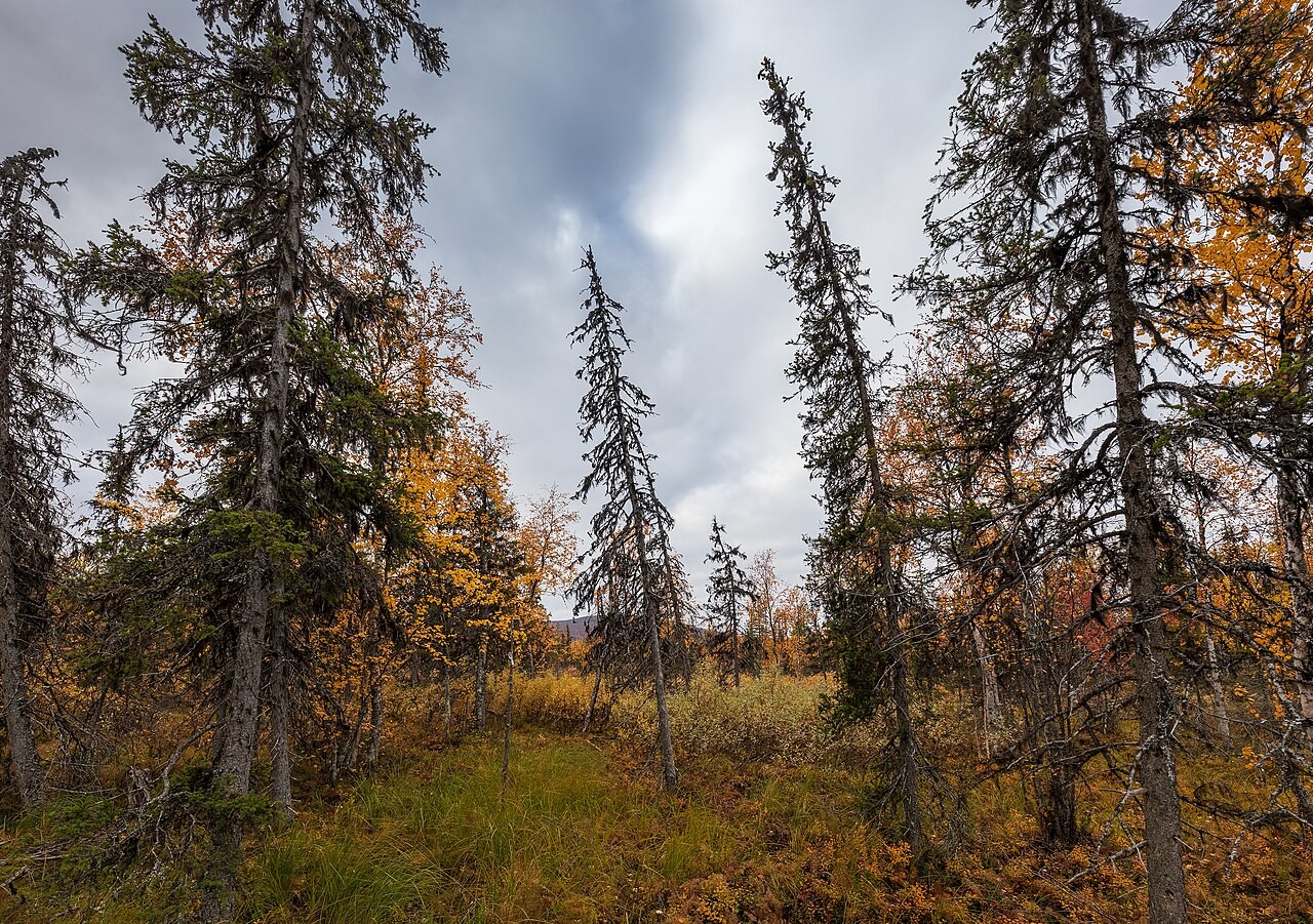
One card’s strip describes trees like these.
Photo: Ximonic (Simo Räsänen), CC BY-SA 4.0
PART 1 · LEARN IT · 1 OF 5
A biome
A biome is a large region with a similar climate and similar plants and animals. Each of your loops is a biome. The cards in one loop grow the same kind of plants.
Photo: King of Hearts, CC BY-SA 4.0
PART 1 · LEARN IT · 2 OF 5
Precipitation
Precipitation is all the water that falls from the sky. That is rain and snow together. Each card gives it in inches for a whole year.
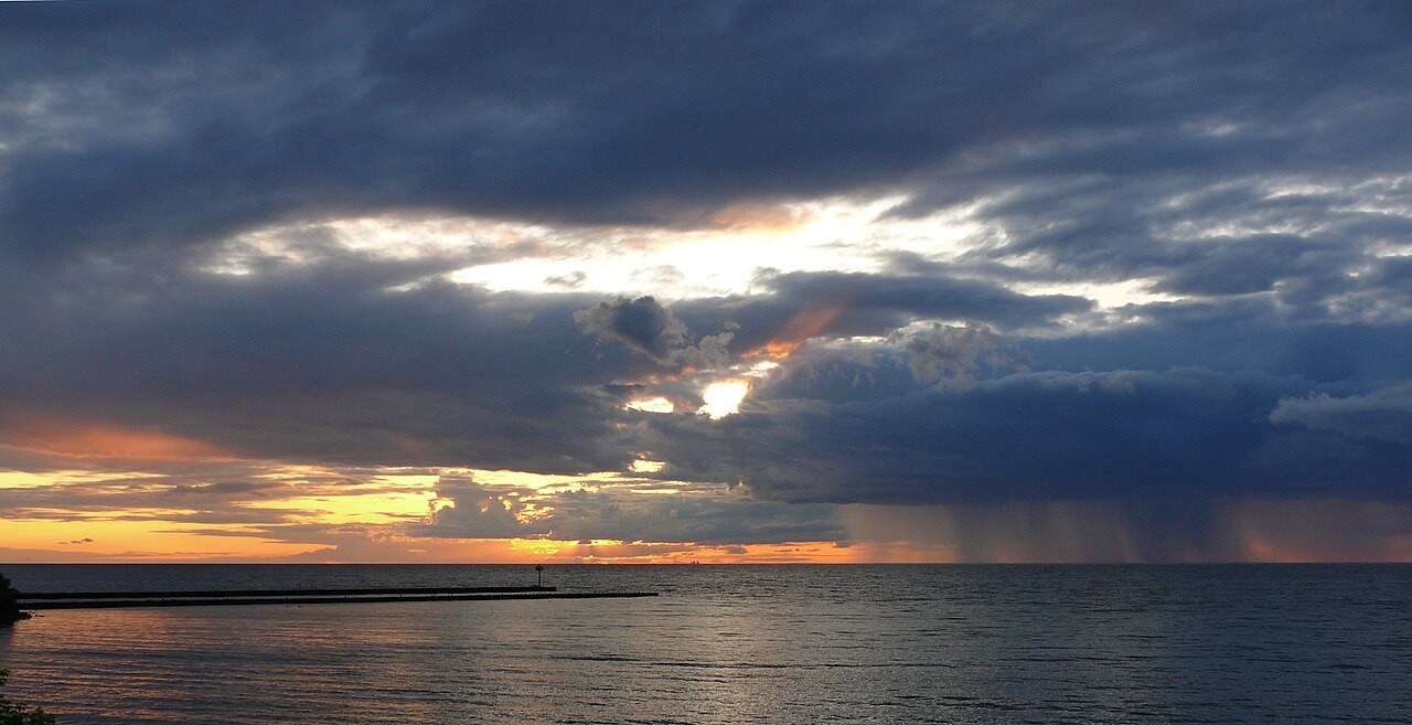
Photo: Ad Meskens, CC BY-SA 3.0
PART 1 · LEARN IT · 3 OF 5
Two numbers decide
Two numbers decide which biome grows in a place. The first is the average temperature for the year. It tells how long plants have to grow. The second is the yearly precipitation. It tells if plants get enough water.
Photo: Famartin, CC BY-SA 3.0
PART 1 · LEARN IT · 4 OF 5
Far apart, same biome
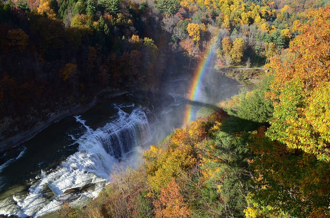
Card A is Hilo, Hawaii. Card B is Manaus, Brazil. They are about 6,000 miles apart. Both are warm, and both get a lot of rain. So both grow tall broadleaf trees that stay green all year. That biome is a tropical rainforest.
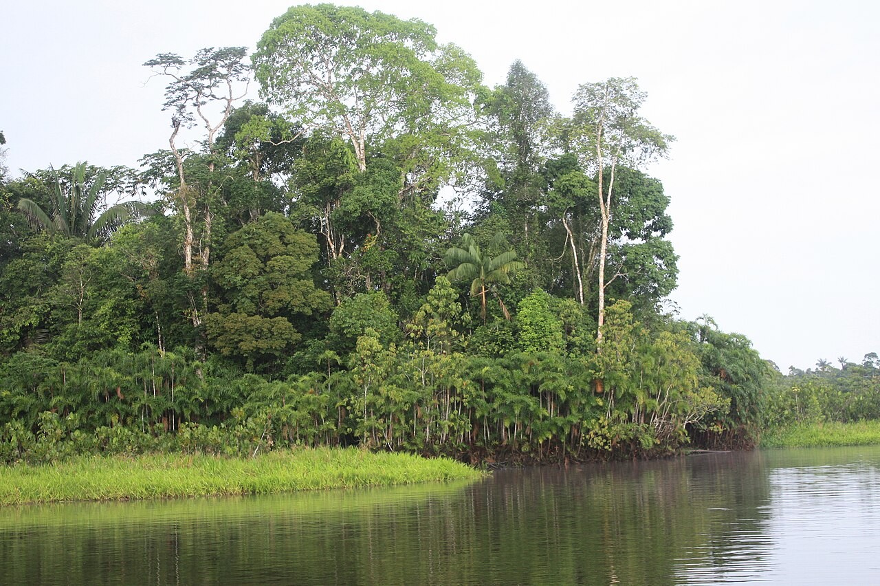
Photo: ALAI, CC BY-SA 4.0
PART 1 · LEARN IT · 5 OF 5
Back to Forks and Yakima
Forks and Yakima have almost the same temperature. But Forks gets 120 inches of precipitation, and Yakima gets 8. That one number makes one a forest of giant, mossy trees and the other a dry land of sagebrush. Tab 3 shows why the rain falls on Forks.
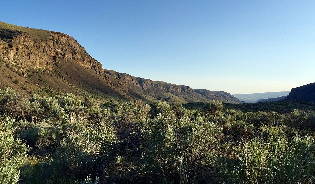
Photo: BLM Oregon and Washington, public domain
PART 1 · QUESTIONS 4 AND 5
Name it, then explain it
QUESTION 4
Biome
Fill the blanks
A biome is a large region with a similar ___ and similar ___ and animals.
Which two yearly numbers decide a biome?
QUESTION 5
A · B
6,000 miles apart
Hilo, Hawaii and Manaus, Brazil grow the same biome.
Why? Use both of their numbers.
TAB 2 · QUESTIONS 6 TO 9
Part 2. The biome map
Now the grid gets names.
Each part of the grid grows one biome. Find out which biome each of your cards is in.
Photo: Daniel Christensen, public domain
PART 2 · TAB 2
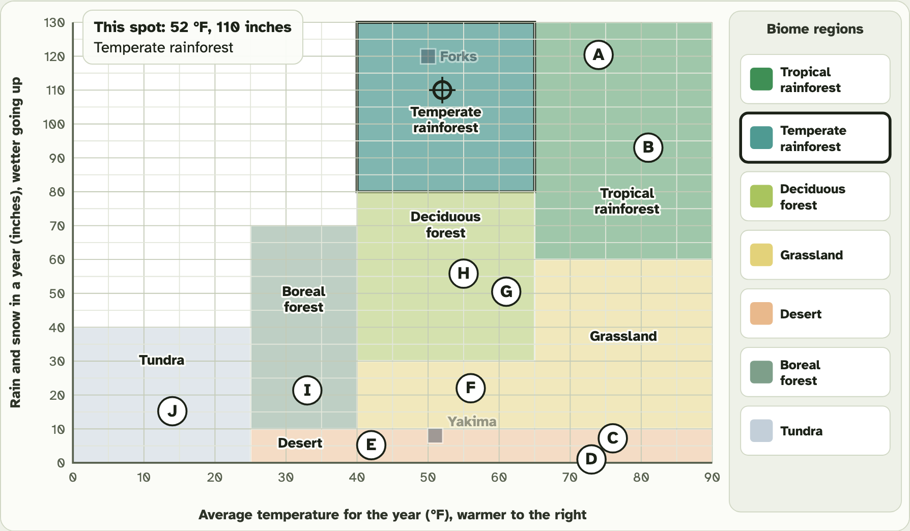
Show the regions
1
Press Show the biome regions.
2
Pick each of the six biomes, on the grid or in the list.
3
Read which cards sit in it.
4
Then look closer at card C and card E.
PART 2 · QUESTION 6
Read a biome
1
The region you picked turns darker on the grid.
2
The box on the side shows a drawing of the biome.
3
It gives the temperature and the rain and snow it needs.
4
It lists the cards that sit in it.
Then tick where each biome sits: warm and wet, dry, in the middle, or cold.
Screenshot: mrsajdak.com/biomes, Tab 2
PART 2 · QUESTION 7
Two cards on the bottom line
QUESTION 7
Card C
Write its year average and its rain and snow.
QUESTION 7
Card E
Write its year average and its rain and snow.
Which region are both cards in?
Screenshot: mrsajdak.com/biomes, Tab 2
PART 2 · LEARN IT · 1 OF 11
Tropical rainforest
Tropical rainforest: warm and wet all year.
Photo: ALAI, CC BY-SA 4.0
PART 2 · LEARN IT · 2 OF 11
Desert
Desert: very dry.
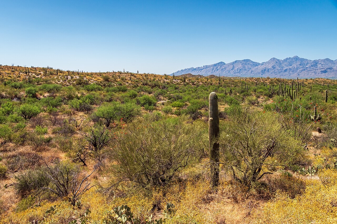
Photo: dconvertini, CC BY-SA 2.0
PART 2 · LEARN IT · 3 OF 11
Grassland
Grassland: in the middle, with too little rain for many trees.
Photo: QKC, CC BY-SA 3.0
PART 2 · LEARN IT · 4 OF 11
Temperate deciduous forest
Temperate deciduous forest: in the middle, with more rain. This is Buffalo’s biome.
Photo: Daniel Christensen, public domain
PART 2 · LEARN IT · 5 OF 11
Boreal forest
Boreal forest: cold, with long winters.
Photo: Ximonic (Simo Räsänen), CC BY-SA 4.0
PART 2 · LEARN IT · 6 OF 11
Tundra
Tundra: very cold, with no trees.
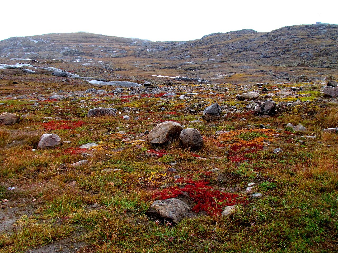
Photo: ADialla, CC BY 2.0
PART 2 · LEARN IT · 7 OF 11
Built for the climate: desert
Plants have parts that fit their climate. A cactus has a thick stem that stores water. It has spines instead of leaves, so it loses very little water to the dry air.
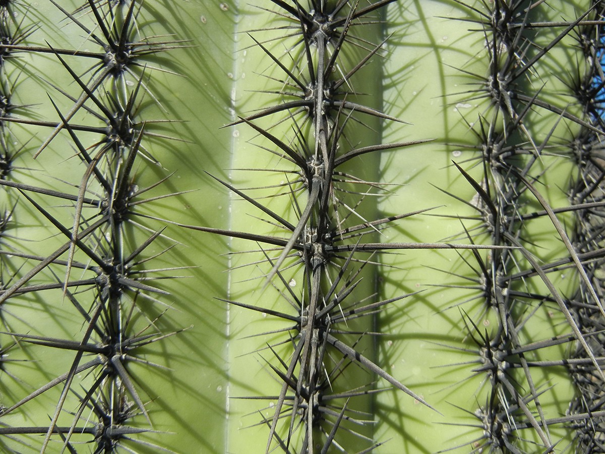
Photo: Alice Wondrak-Biel, public domain
PART 2 · LEARN IT · 8 OF 11
Built for the climate: boreal forest
Spruce and pine trees have thin needles with a waxy coat. Needles lose little water in the cold, dry winter, and snow slides off them. They stay green all year, so the tree can start growing as soon as it warms up.
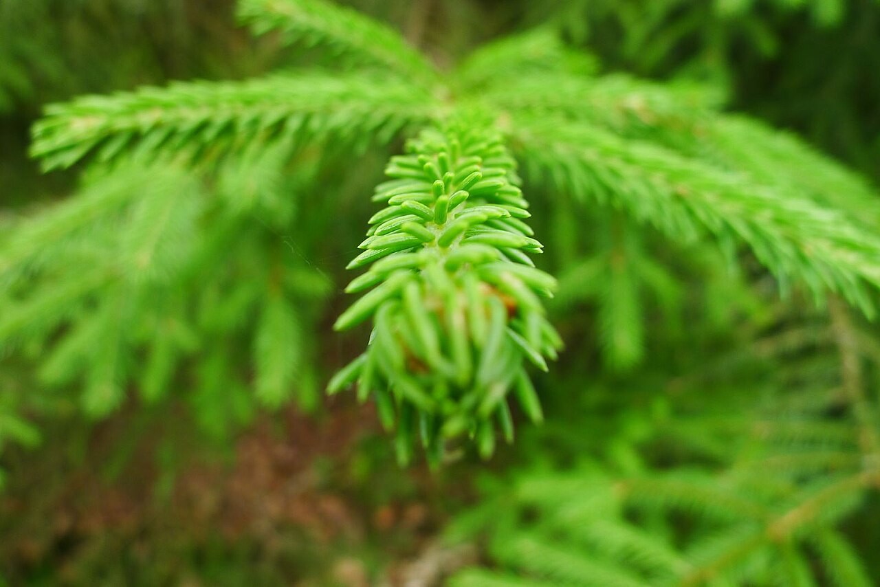
Photo: Timo Newton-Syms, CC BY-SA 2.0
PART 2 · LEARN IT · 9 OF 11
Built for the climate: deciduous forest
Oak and maple trees have broad, flat leaves. Wide leaves catch lots of sunlight in a warm, wet summer. The trees drop them in fall, before the water in the ground freezes.
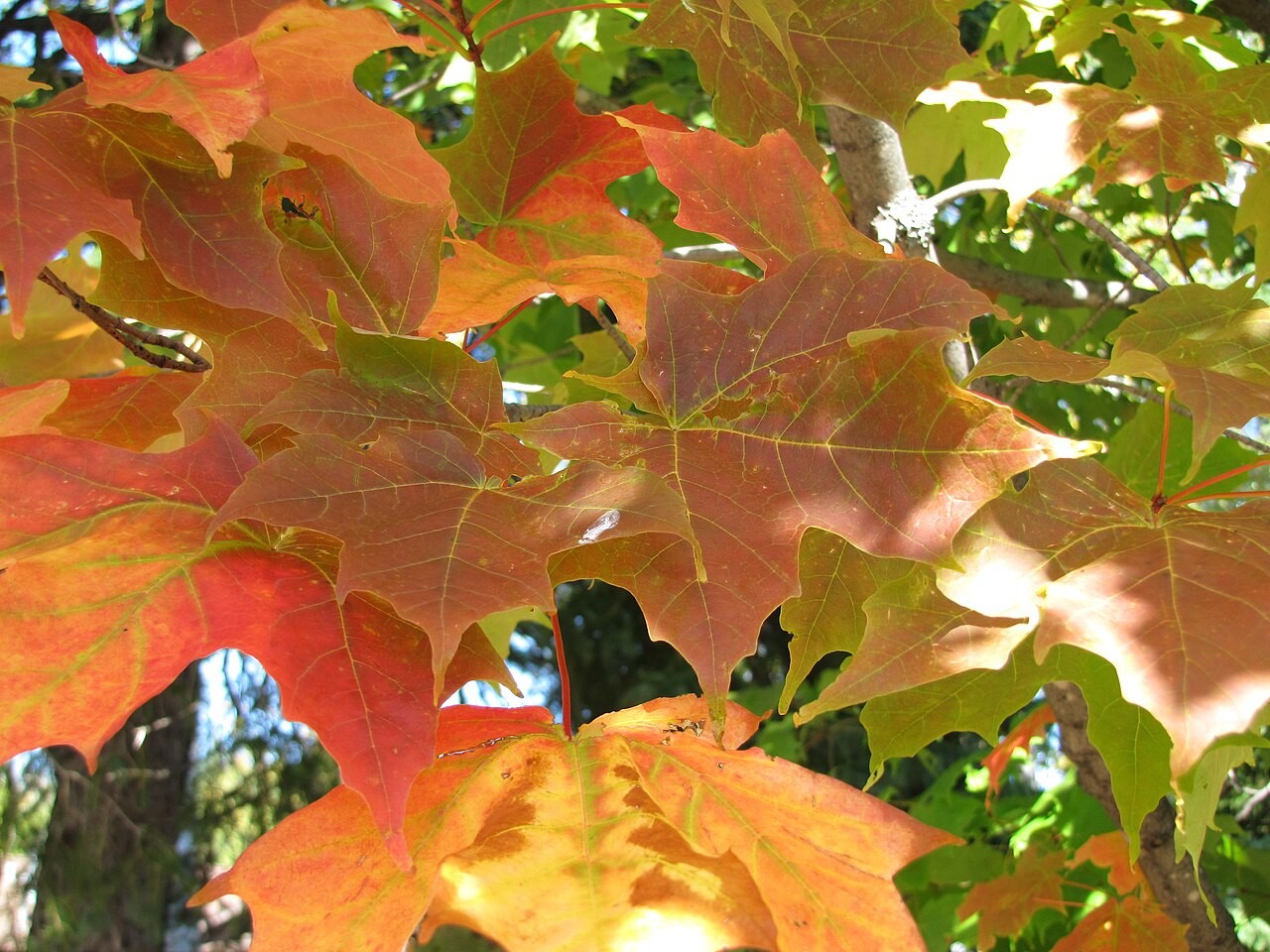
Photo: Superior National Forest, CC BY 2.0
PART 2 · LEARN IT · 10 OF 11
Built for the climate: tundra
Tundra plants grow low, out of the cold wind. A little way down, the ground stays frozen all year, so tree roots cannot grow deep. Mosses and lichens can live there.
Photo: ADialla, CC BY 2.0
PART 2 · LEARN IT · 11 OF 11
A desert is about rain, not heat
A desert gets very little precipitation, less than about 10 inches a year. A desert can be hot or cold. Card E is the Gobi, in Mongolia. It averages only 42°F, and it gets about 5 inches a year. It is a cold desert.
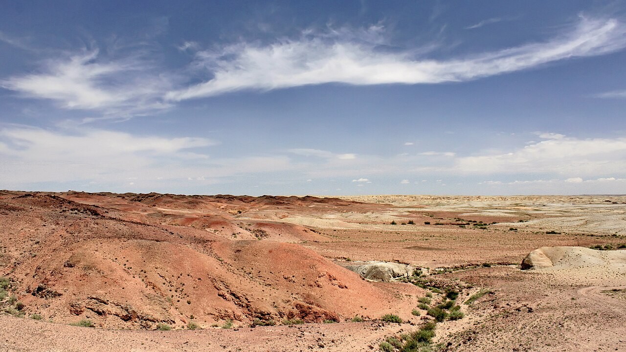
Photo: Marcin Konsek, CC BY-SA 4.0
PART 2 · QUESTIONS 8 AND 9
Built for it, and a claim
QUESTION 8
Built for
Which biome?
A thick stem, thin needles, broad leaves: tick a biome for each.
Pick one. How does its build help it live in that climate?
QUESTION 9
True?
“Deserts are always hot.”
Tick true or false.
Use card E’s two numbers as evidence.
Say what makes a desert a desert.
TAB 3 · QUESTIONS 10 TO 13
Part 3. Rising air, rain shadows
Why does the rain fall where it does?
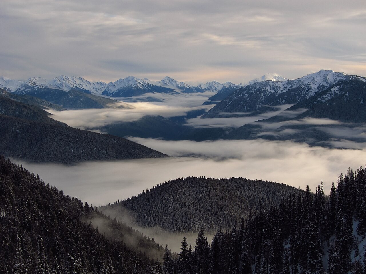
You will follow air up at the equator and down near 30°. Then you will push wet air over a mountain.
Photo: Olympic National Park, public domain
PART 3 · QUESTION 10
Follow the air
1
Pick Around the world.
2
Press Follow the air. Watch it all the way around.
3
Copy the three rows from the table into Question 10.
4
Move the marker to 0°, then to 30° N. Is the air rising or sinking?
PART 3 · QUESTION 10
Read the moving air
1
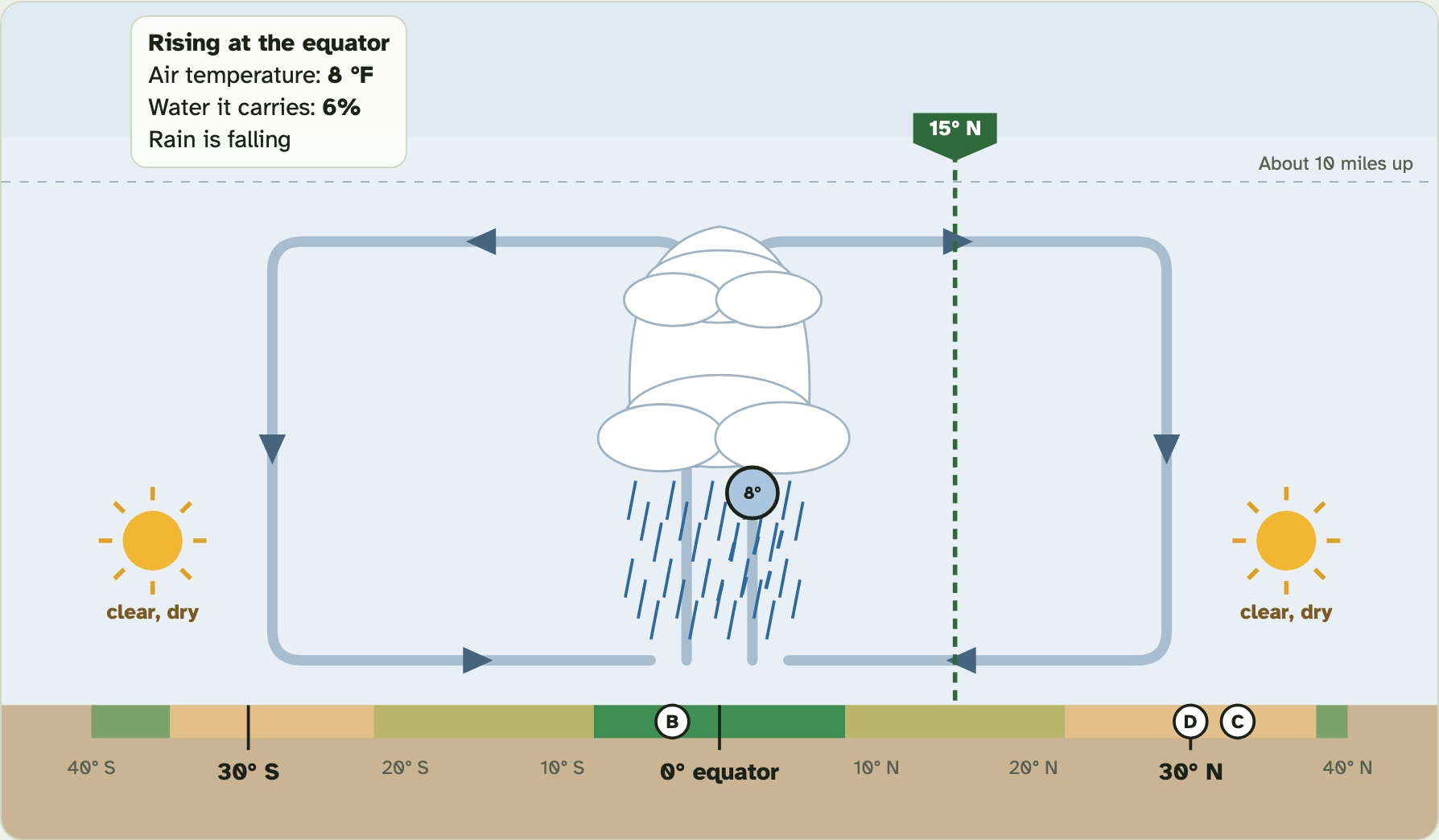
The box at the top left follows the air.
2
It shows the air’s temperature right now.
3
It shows how much of its water the air still carries.
4
The blue lines under it are rain.
The screenshot is part way up. Your table needs the start, the top, and the ground at 30° N.
Screenshot: mrsajdak.com/biomes, Tab 3
PART 3 · QUESTION 11
Over a mountain
1
Pick Over a mountain.
2
Set the mountains to 0 ft. Press Send in ocean air.
3
Do it again at 2,000, 4,000 and 6,000 ft.
4
Copy each row from Your mountain runs.
PART 3 · LEARN IT · 1 OF 4
Rising air makes rain
The sun heats the equator the most. Warm, wet air there rises. As it rises, it cools. Cool air cannot hold as much water. The extra water forms clouds and falls as rain, almost every day. That is why rainforests grow near the equator.
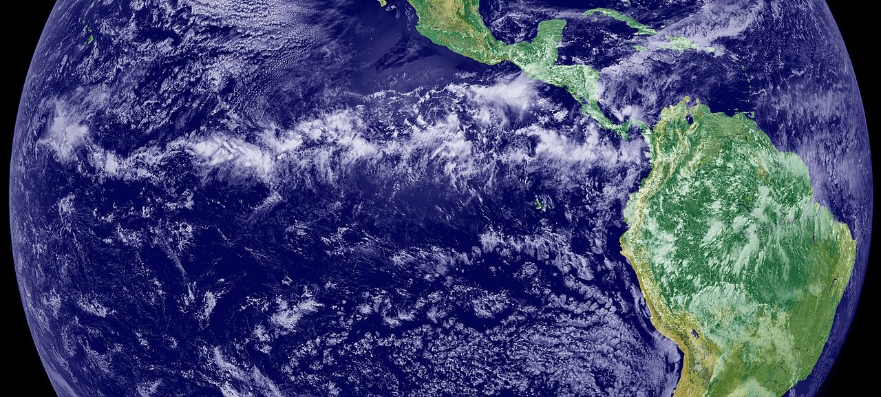
Photo: NASA Earth Observatory, public domain
PART 3 · LEARN IT · 2 OF 4
Sinking air makes deserts
High up, the air spreads out. It comes back down near 30° north and 30° south. Sinking air warms up, and it has already dropped its water. So clouds do not form. Many big deserts sit near 30°, like the Sahara (card D, Cairo) and the deserts of Arizona (card C, Phoenix).
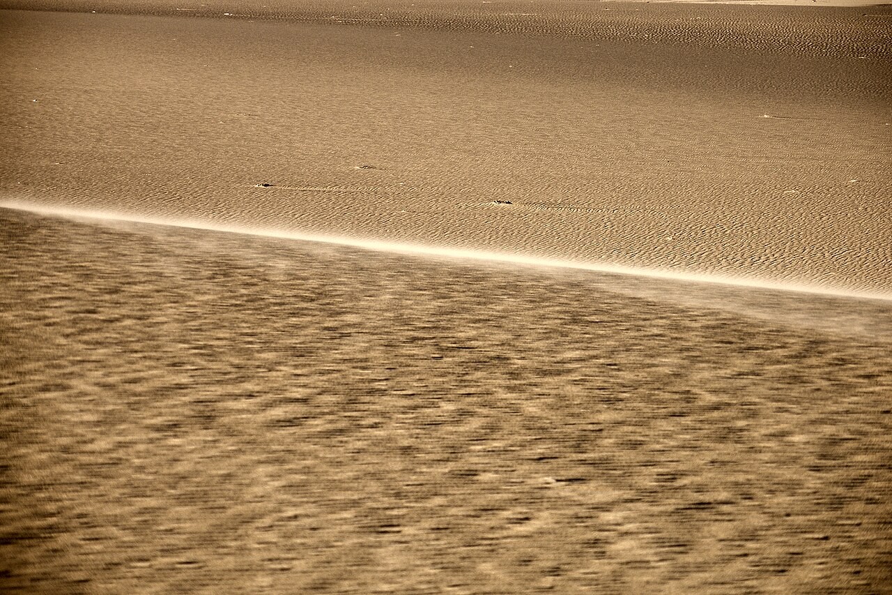
Photo: Vyacheslav Argenberg, CC BY 4.0
PART 3 · LEARN IT · 3 OF 4
The rain shadow
Mountains do the same thing on a small scale. Wet air from the ocean hits the mountains and rises. It cools and drops its rain on the ocean side. Then it sinks down the far side and warms. It has little water left. The dry land on the far side of a mountain range is called a rain shadow. The taller the mountains, the darker the shadow.
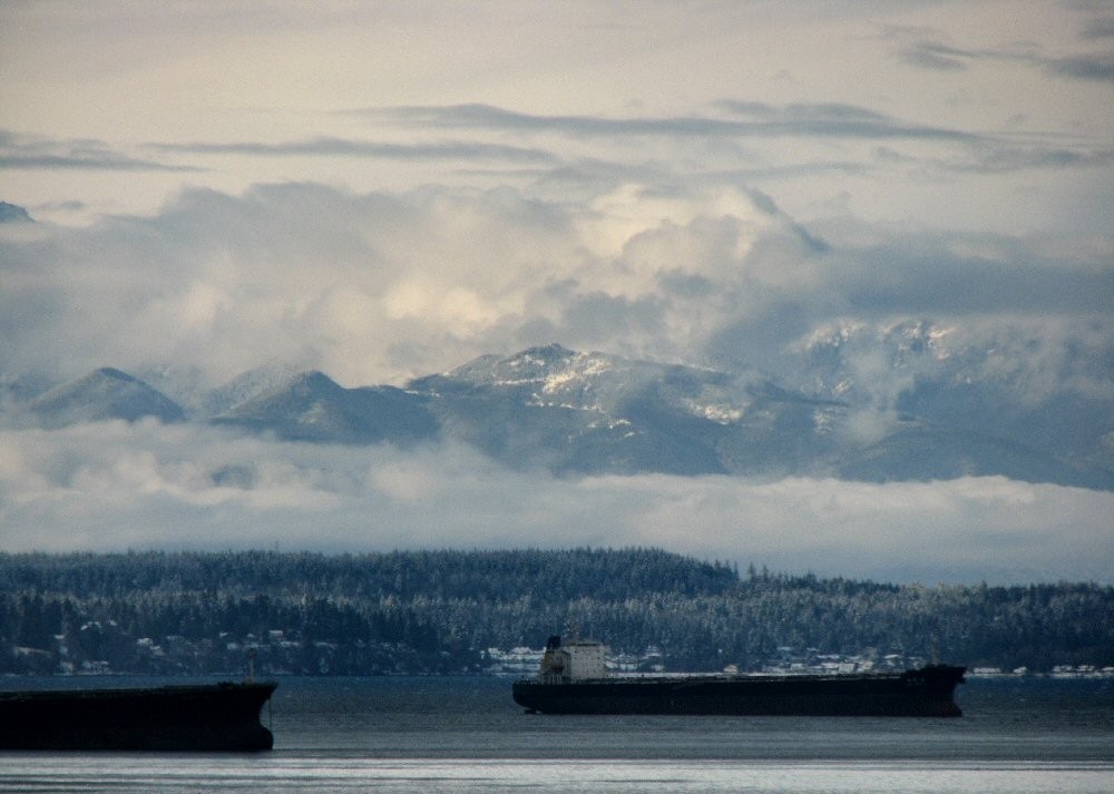
Photo: katharine moriarty, CC BY 2.0
PART 3 · LEARN IT · 4 OF 4
Forks and Yakima, explained
Forks is on the ocean side of the mountains. Wet air rises there and drops about 120 inches a year. Yakima is on the far side, in the rain shadow. It gets about 8 inches. Same latitude, same temperature, but different precipitation, so a different biome.
Photo: BLM Oregon and Washington, public domain
PART 3 · QUESTIONS 12 AND 13
Explain the rain
QUESTION 12
0° · 30°
Fill the blanks
At the equator, warm wet air ___ and cools, so it drops ___.
Near 30°, dry air ___ and warms, so the land there is often a ___.
QUESTION 13
120 · 8
Forks and Yakima
Why does Forks get 120 inches and Yakima only 8?
Use the words rain shadow and two numbers from Question 11.
TAB 4 · QUESTIONS 14 TO 18
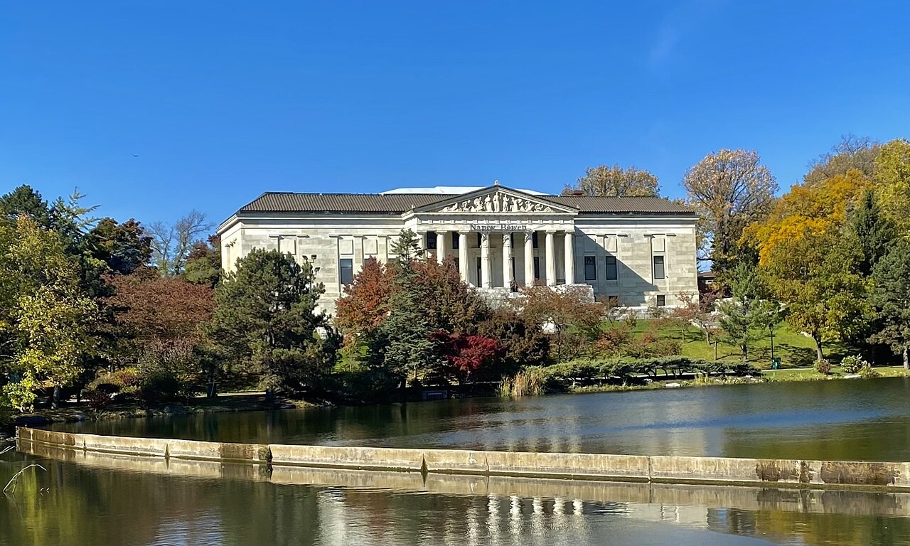
Part 4. Buffalo and city L
Two new cards. Card K is us: Buffalo.
Card L is a mystery city at 43° N, exactly Buffalo’s latitude.
Photo: Andre Carrotflower, CC BY-SA 4.0
PART 4 · QUESTIONS 14 AND 15
Place K and L, then dry out Buffalo
1
Drag card K to its spot. Then card L.
2
Read the biome each one lands in. Fill Question 14.
3
In A drier Buffalo, move the slider to 30. Press Record.
4
Do the same at 15 and 5. Fill Question 15.
PART 4 · QUESTION 14
Two cards, month by month
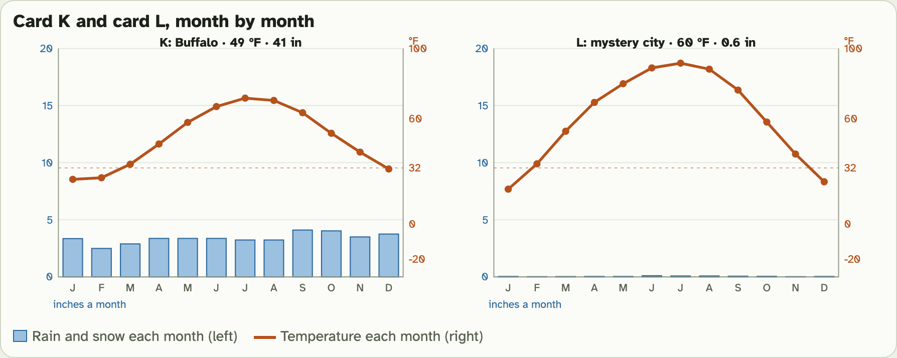
Same latitude. Look at the bars.
Screenshot: mrsajdak.com/biomes, Tab 4
PART 4 · LEARN IT · 1 OF 3
City L is Turpan, China
Turpan sits at 43° N, the same latitude as Buffalo. It is a desert of bare rock and gravel. It is very far from any ocean, and tall mountains block the wet air. Farms there grow only where water from the mountains is piped in.
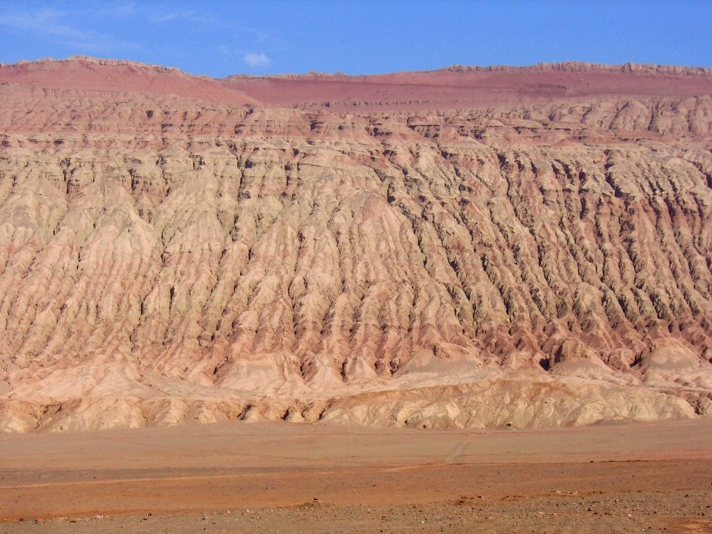
Photo: Colegota, CC BY-SA 2.5 es
PART 4 · LEARN IT · 2 OF 3
Latitude is not enough
Latitude helps set the temperature. But a biome needs both numbers. Buffalo and Turpan share a latitude. Buffalo gets 41 inches of precipitation a year. Turpan gets 0.6 inches. So Buffalo grows a forest and Turpan is a desert.
Photo: Andre Carrotflower, CC BY-SA 4.0
PART 4 · LEARN IT · 3 OF 3
A biome lasts as long as its climate
A biome stays the same as long as its climate stays the same. If Buffalo got much less rain and snow, year after year, many trees would die. Fewer young trees would grow. Over many years, grasses would take over. One dry year would not do it. One year is weather. It takes a long change in climate to change a biome.
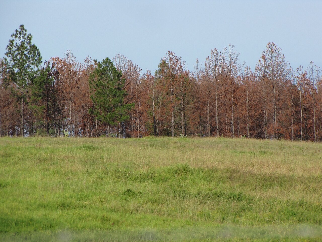
Photo: Forest and Kim Starr, CC BY 3.0
PART 4 · QUESTIONS 16 AND 17
Same latitude, and a long change
QUESTION 16
43° N
Buffalo and Turpan
Both are at 43° N. Why do they grow different biomes?
Use both numbers for both places.
QUESTION 17
100 years
A drier Buffalo
15 inches a year for 100 years: what happens to the forest?
Would one dry year do the same? Why or why not?
WRAP IT UP · QUESTION 18
Does latitude decide?
The claim
“If you know a place’s latitude, you know its biome.”
Pair 1
Two places at about the same latitude that grow different biomes.
Pair 2
Two places far apart that grow the same biome.
Reasoning
Argue against the claim. Say what really decides the biome.
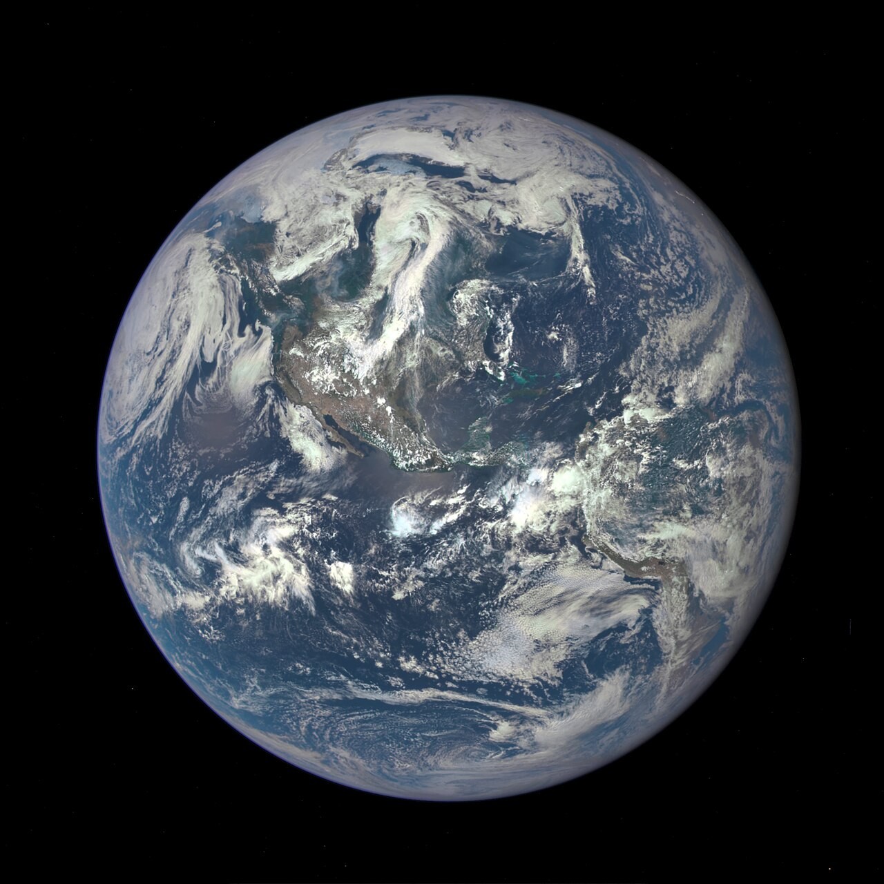
Every latitude has more than one biome.
Photo: NASA, public domain
WRAP IT UP · BACK TO THE START
Revisiting the Phenomenon
How can two numbers tell you what grows in a place?
1Using evidence from today, explain why the trail near Forks is a rainforest and the trail near Yakima is dry.
2Which of the two numbers is almost the same for the two towns, and which is very different?
3How do the mountains between them cause the difference?
4Which numbers from your worksheet best support your explanation?
Photo A: the Hoh Rain Forest, near Forks.
Photo B: Cowiche Canyon, near Yakima.
Photos: King of Hearts, CC BY-SA 4.0 · BLM Oregon and Washington, public domain
LAST CHECK
Before you hand it in
Name, date and period are on top.
All the tables are full.
Questions 6 and 8 have one tick in each row.
Every explanation uses both numbers.
Photo: Vyacheslav Argenberg, CC BY 4.0