ENVIRONMENTAL SCIENCE · LESSON 6.1
Currents and Climate
Follow along with your worksheet, one question at a time.
mrsajdak.com/currents
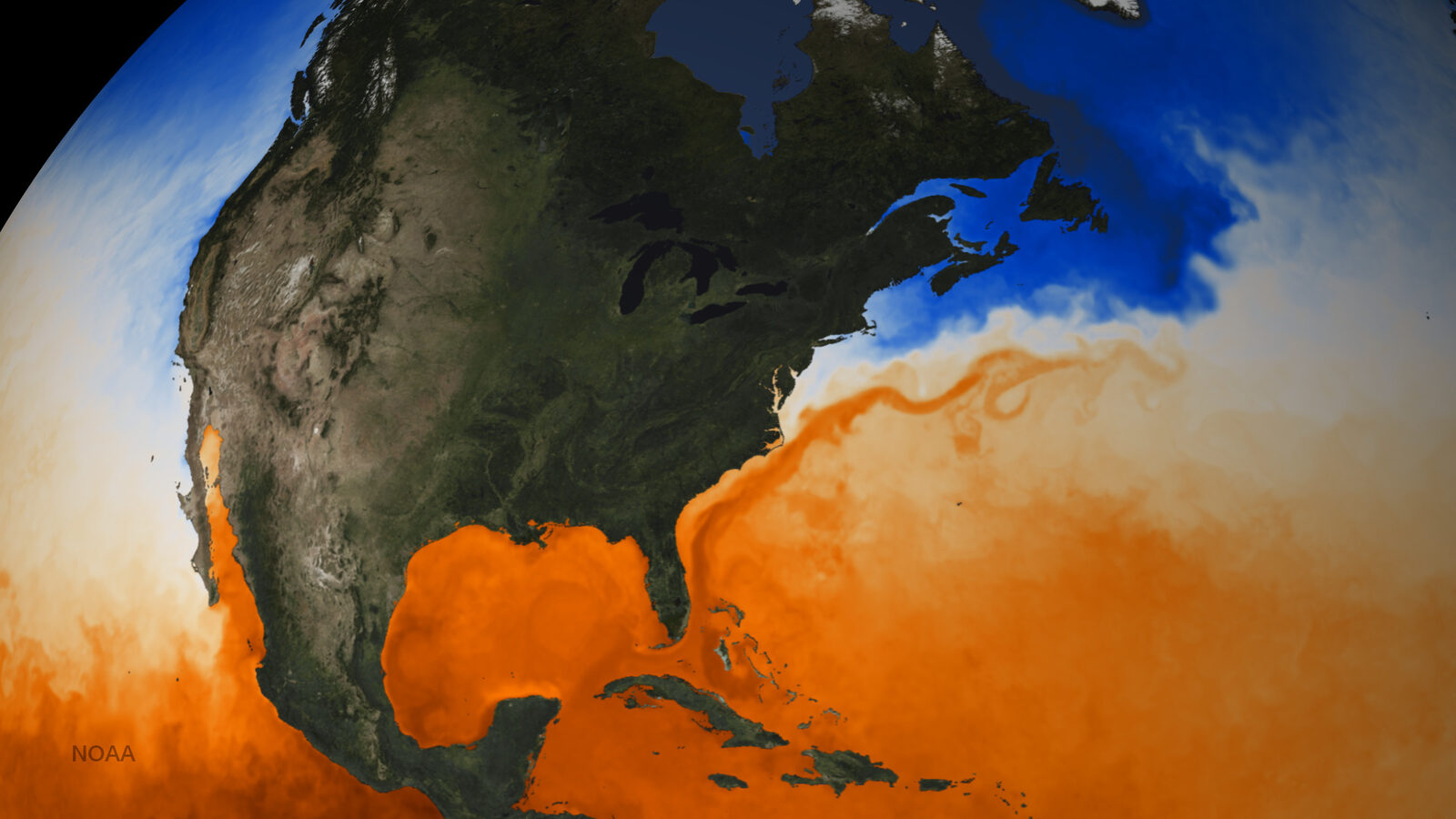
Map: NOAA, public domain
START HERE · PICK AN OPENER
Choose how to open the lesson
Click a card to jump to it. Every option ends at the same Observe, Wonder, Predict slide and the same driving question.
OPTION A · VIDEO
The Ocean on the Move
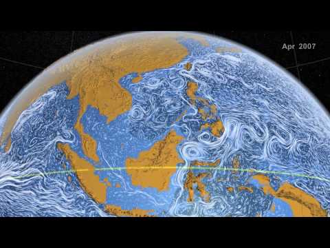
Clip 1 is NASA’s Perpetual Ocean: real ocean currents from about two years, sped up. Clip 2 is a short NOAA globe of currents colored by temperature. Clip 3 is an iceberg grounded off the coast of Labrador, Canada.
Watch for
Find Florida. Which way does the water near it move?
Where does that water go next?
Clip 3: this coast is about as far north as London. Why is there ice?
Videos on YouTube: NASA Goddard; NOAA SOS; Mark Normore.
OPTION B · TRY IT · 4 MINUTES
Hot Over Cold
1
Fill one small jar to the brim with hot tap water and 3 drops of red food coloring.
2
Fill a matching jar to the brim with ice water and 3 drops of blue food coloring.
3
Lay an index card over the cold blue jar. Hold the card, turn the jar over, and set it on top of the hot red jar.
4
Hold the jars over a tray. Slide the card out slowly. Watch for one minute.
You need
Two matching small jars (baby food or spice jars)
Hot tap water and ice water
Red and blue food coloring
An index card and a tray or towel
Watch for
Cold on top, hot below: what do the colors do?
How fast does the water mix?
What would happen if the hot jar were on top?
OPTION C · PHOTOS
Phenomenon: Two Coasts in Winter
Photos: No Swan So Fine, CC BY-SA 4.0 · Jeff Schmaltz, NASA MODIS, public domain
START HERE
Observe, wonder, predict
Photo A is green in January. Photo B is buried in snow and sea ice. The two places are almost the same distance from the equator. They get about the same sunlight.
OBSERVEWhat do you notice about the ground and the water in each place?
WONDERWhat do you wonder about these two places?
PREDICTIf they get the same sunlight, what else could make one place so much warmer? Explain your reasoning.
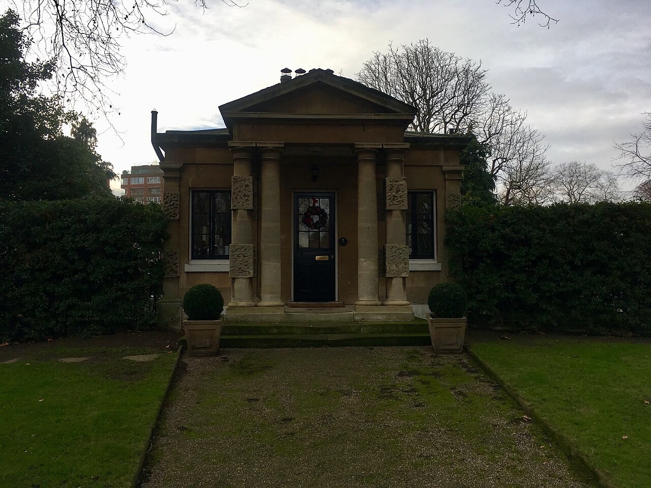
Photo A, up close.
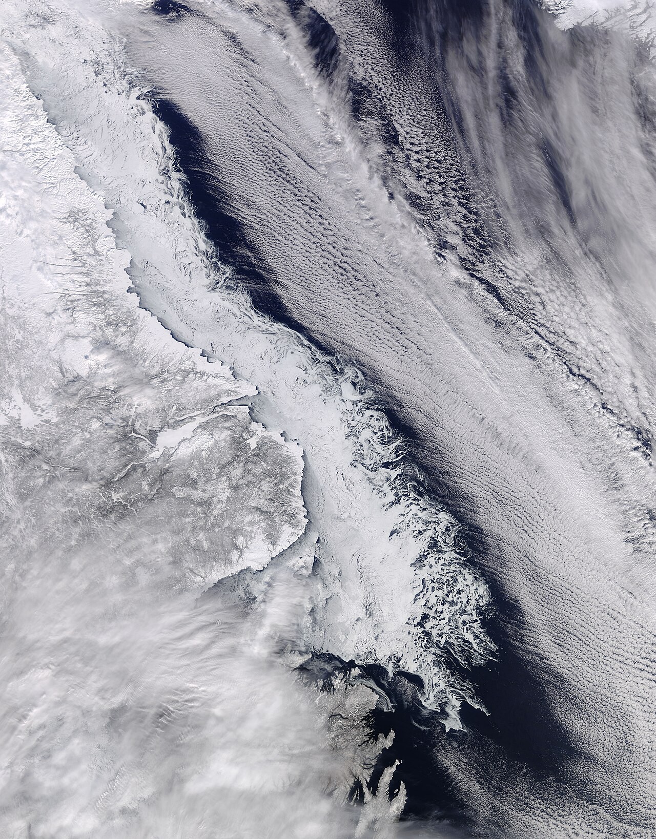
Photo B, up close.
Photos: No Swan So Fine, CC BY-SA 4.0 · Jeff Schmaltz, NASA MODIS, public domain
DRIVING QUESTION
Why are some coasts mild and others frozen, at the same distance from the equator?
START HERE
Where Are These Places?
Finished observing? Click here to find out.
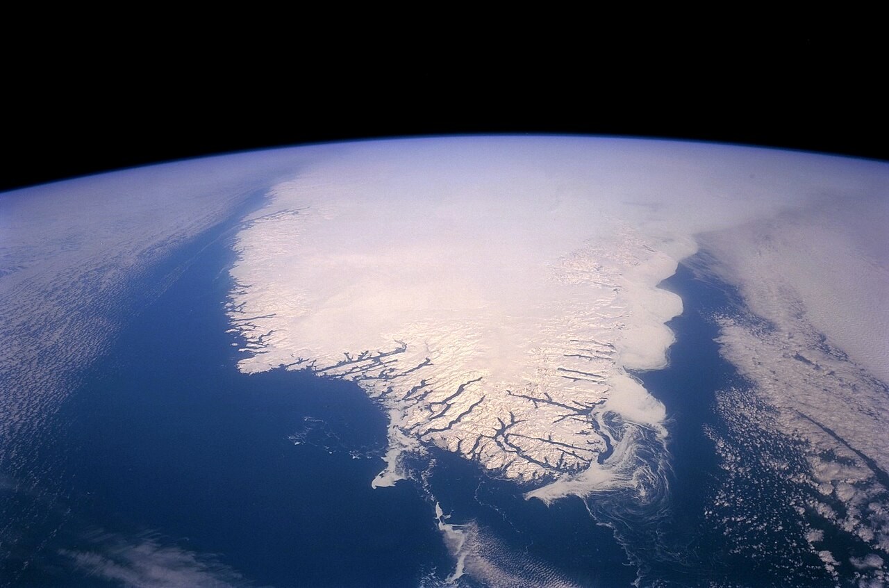
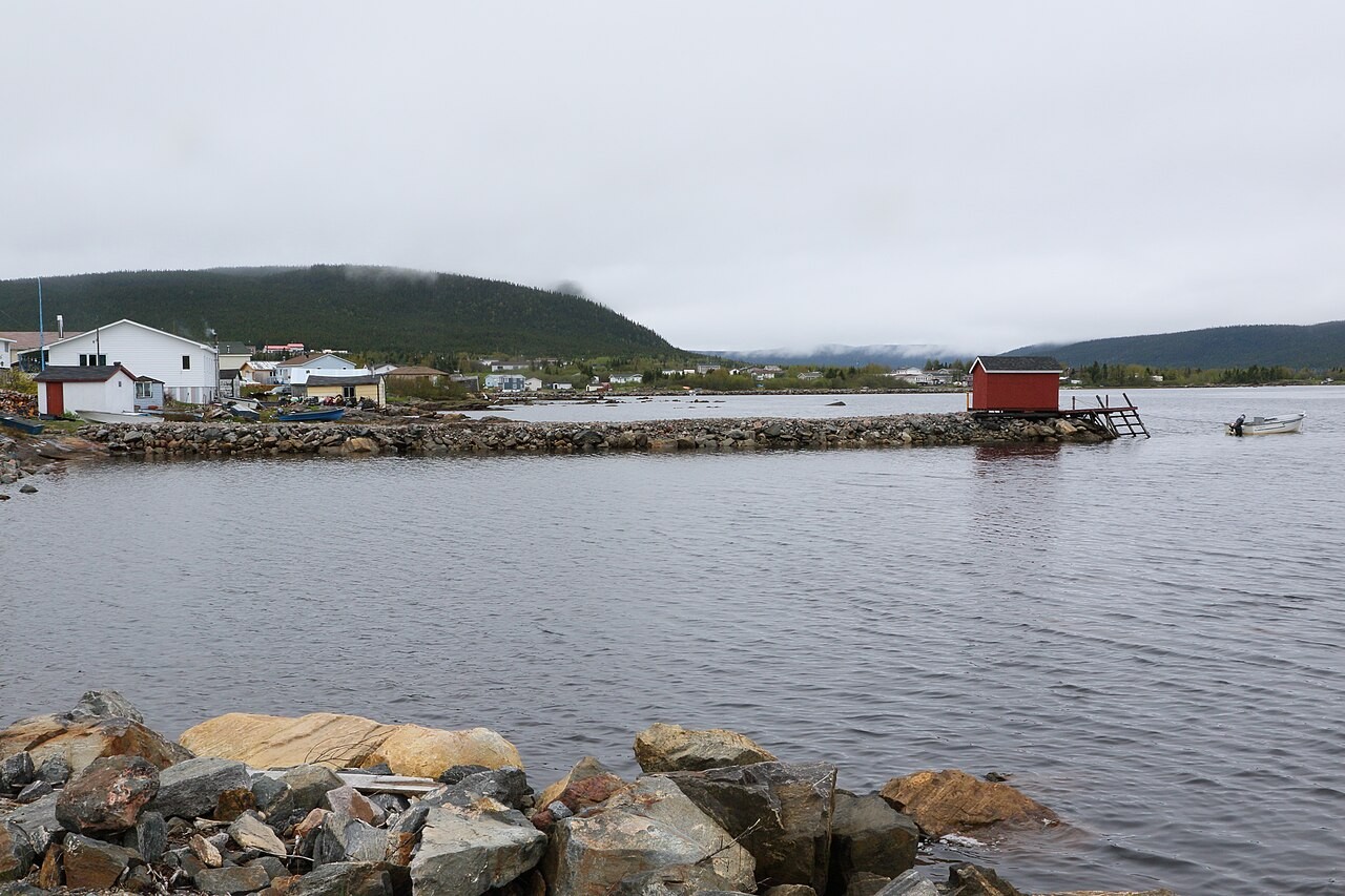
Photo A is Hyde Park in London, England, in January. London is at 51.5° N. Photo B is the coast of Labrador, Canada, near the town of Cartwright, seen from a satellite. Cartwright is at 53.7° N, only a little farther north. London's January averages 42°F. Cartwright's averages 7°F.
Watched the video or tried it? Click here.
The video shows real ocean water moving, measured over about two years and sped up. The iceberg is at L'Anse au Loup, Labrador, at 51.5° N: the same latitude as London. In the jars, the cold blue water sank into the hot red water.
Today, you will build a current in a box of water. You will read real ocean temperatures and real city climates on both sides of the Atlantic. Then you will follow real winds measured from space. At the end, you will return to the driving question.
BEFORE YOU START
Words and units for this lab
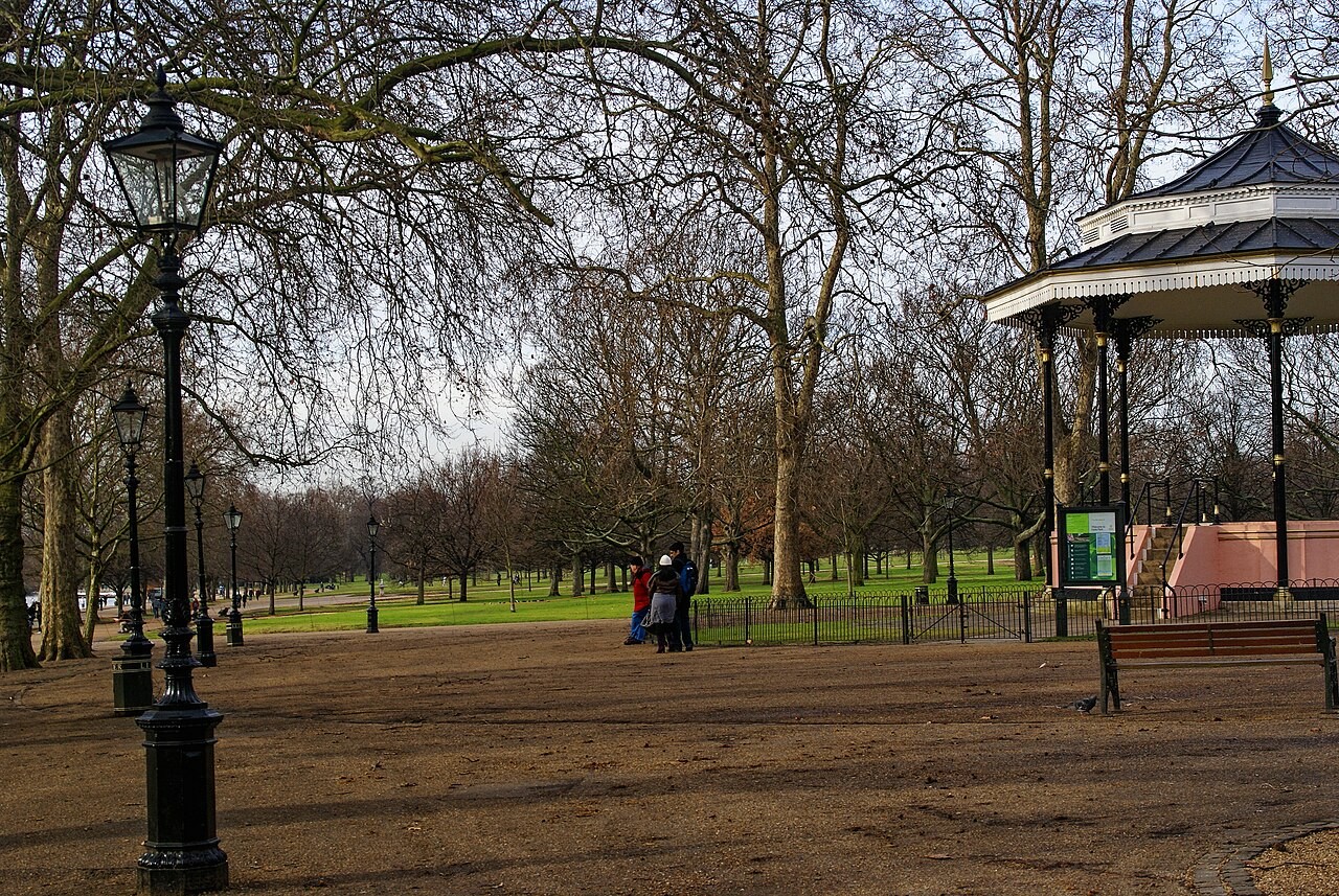
Hyde Park, London, in winter. The grass stays green.
Words for this lab
Latitude is how far a place is from the equator, in degrees north or south. Buffalo is at 43° N.
°C is degrees Celsius. Water freezes at 0°C. °F is degrees Fahrenheit. Water freezes at 32°F.
cm/s means centimeters per second. m/s means meters per second. Both are speeds.
Is London mild because it is closer to the sun?
Photo: Txllxt TxllxT, CC BY-SA 4.0
BEFORE YOU START
What you will learn
I can use a model to show how uneven heating makes water move in a loop.
I can explain how an ocean current carries heat and changes the climate of a coast.
I can explain how Earth's spin bends the winds.
BEFORE YOU START
Get set up
1
Open mrsajdak.com/currents on your device.
2
Write your name, the date and your period on the worksheet.
3
Find the three tabs at the top of the lab. Each tab goes with one part of the worksheet.
4
Start on Tab 1. Do not skip ahead.

| Tab in the lab | Worksheet | Questions |
|---|---|---|
| 1. Currents in a box | Part 1 | 1 to 6 |
| 2. Two coasts | Part 2 | 7 to 11 |
| 3. Winds on a spinning Earth | Part 3 and Wrap it up | 12 to 16 |
Screenshot: mrsajdak.com/currents
TAB 1 · QUESTIONS 1 TO 6
Part 1. Currents in a box
A box of water. Ice at one end, hot water at the other.
Does the water just sit there?
Photo: USGS, public domain
PART 1 · TAB 1
Run the four setups
1
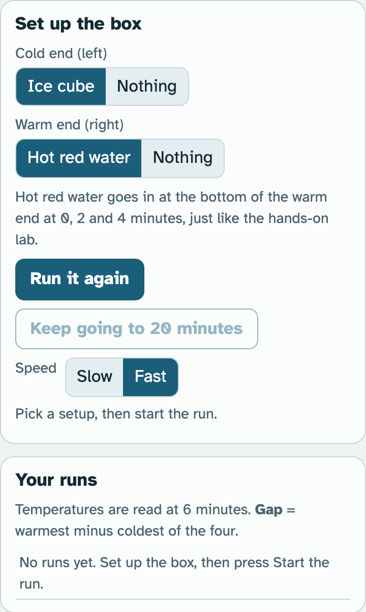
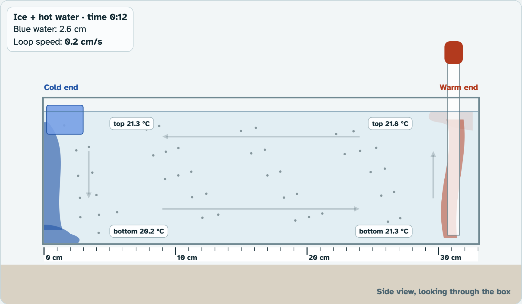
Set up Ice cube and Hot red water. Press Start the run.
2
Watch the blue and the red water. It stops at 6 minutes.
3
Run Ice only, then Hot water only, then Neither.
4
Run Ice + hot water again. Press Keep going to 20 minutes.
PART 1 · QUESTION 1
Copy your runs
1
Find Your runs in the lab.
2
Copy the time the blue water reached 20 cm. No ice means a dash.
3
Find the coldest and the warmest of the four readings.
4
Copy the Gap and the Loop at 6 min.
Example
Four readings: 20.0, 14.0, 23.5 and 18.0.
Coldest 14.0. Warmest 23.5.
23.5 − 14.0 = 9.5
These are not your numbers. Use your own.
The lab works out the gap for you.
Screenshot: mrsajdak.com/currents, Tab 1
PART 1 · QUESTIONS 2 AND 3
Read the box, then plan check
QUESTION 2
Coldest and warmest
In the ice + hot water run, where was the coldest water? Where was the warmest?
Then copy the loop speed at 20 minutes.
QUESTION 3
Plan check
What did you change from run to run?
Why is the Neither run useful?
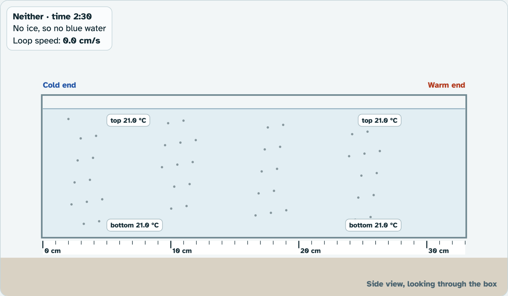
Screenshot: mrsajdak.com/currents, Tab 1
PART 1 · LEARN IT · 1 OF 6
Cold water sinks, warm water rises
Cold water is denser than warm water. Denser means more mass packed into the same space, so it is heavier for its size. The cold blue water sank and crept along the bottom. The warm red water rose and spread across the top.
Screenshot: mrsajdak.com/currents, Tab 1
PART 1 · LEARN IT · 2 OF 6
A loop that carries heat
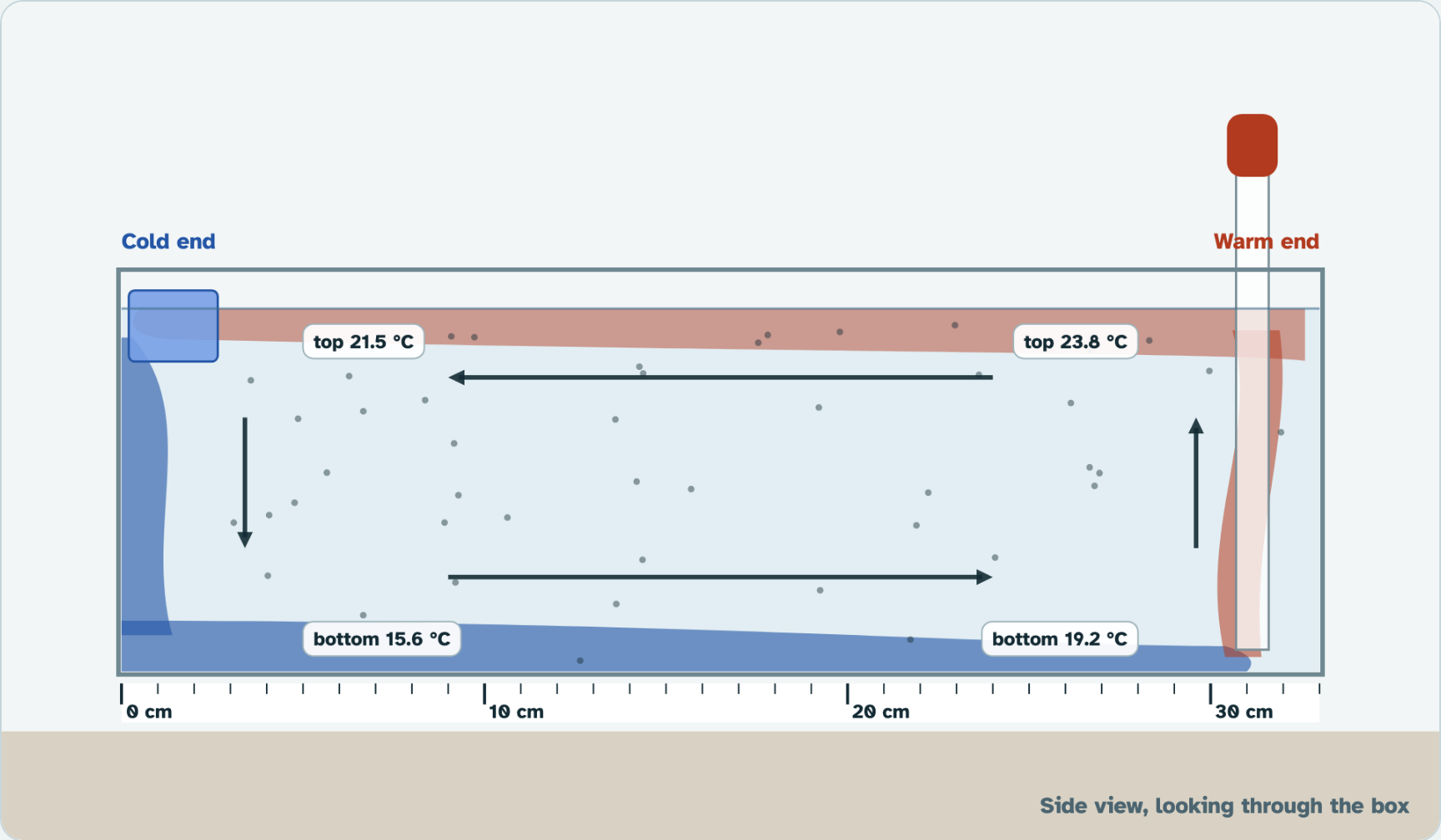
Together they made a loop. Warm water moved across the top toward the cold end. Cold water moved along the bottom toward the warm end. This is convection: a fluid, like water or air, heated in one place and cooled in another, moves in a loop and carries heat with it.
Screenshot: mrsajdak.com/currents, Tab 1
PART 1 · LEARN IT · 3 OF 6
Both ends make the loop
With ice and hot water, the loop was strongest and the blue water was fastest. With only one end, the loop was weaker. With neither, nothing moved. Heat does not just "rise." Warm water rises because the colder, heavier water sinks under it and pushes it up.
Screenshot: mrsajdak.com/currents, Tab 1
PART 1 · LEARN IT · 4 OF 6
The loop needs a cold end
When the ice melted and the hot water cooled, the loop slowed down and stopped. The ends were no longer different. A loop like this lasts only while one end stays cold and the other stays warm.
Photo: Jeff Schmaltz, NASA MODIS, public domain
PART 1 · LEARN IT · 5 OF 6
Salty water sinks too
Salt makes water denser. Cold, salty water sinks even faster than cold fresh water. In the real ocean, both cold and salt make water sink.
Photo: USGS, public domain
PART 1 · LEARN IT · 6 OF 6
Your box is a model
The ice end stands for the ocean near the poles. The hot end stands for the ocean near the equator. The box stands for the ocean between them. The real ocean is thousands of kilometers wide, and it has wind, salt, continents and a spinning Earth. The box has none of those.
Map: NOAA, public domain
PART 1 · QUESTIONS 4 AND 5
Explain what you saw
QUESTION 4
Why the colors went where they did
Use the word denser.
Why did the blue water sink and creep along the bottom, while the red water rose?
QUESTION 5
Why the loop stopped
Which run had the fastest loop? What was it at 20 minutes?
Explain why the convection loop stopped.
PART 1 · QUESTION 6
Model check
QUESTION 6
What does each part stand for?
The ice end stands for ...
The hot end stands for ...
Name one thing the real ocean has that the box does not.
Photo: USGS, public domain
TAB 2 · QUESTIONS 7 TO 11
Part 2. Two coasts
Real ocean temperatures from satellites and ships.
Real January temperatures for seven places.
Photo: Cephas, CC BY-SA 4.0
PART 2 · TAB 2
Record the places
1
Pick Bordeaux. Press Record.
2
Do the same for every place, Buffalo too.
3
Look at the color of the sea next to each one.
4
Press Show currents.
PART 2 · QUESTIONS 7 AND 8
Read the pairs
1
Copy each place from Your places.
2
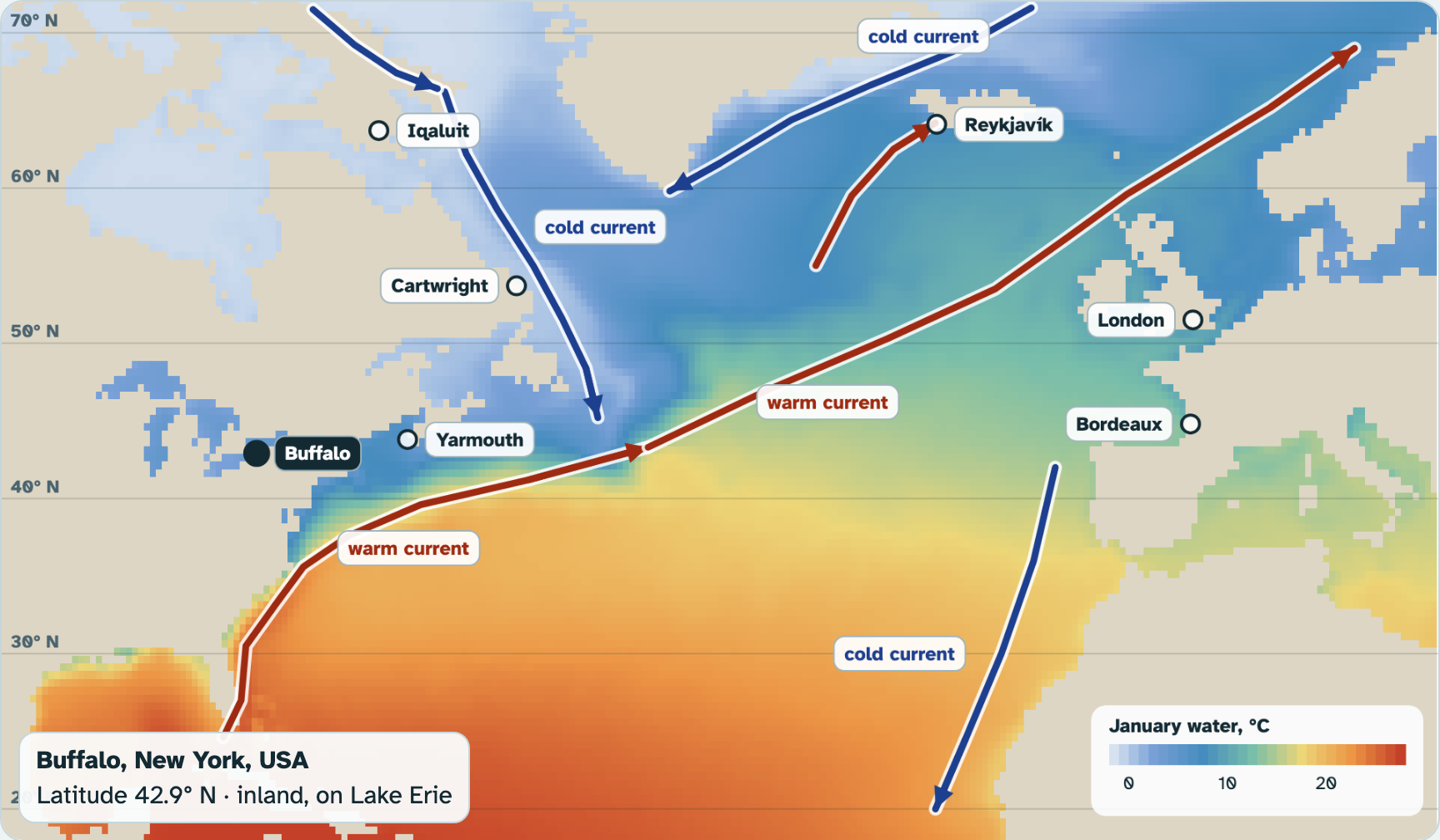
The places come in pairs at about the same latitude.
3
In each pair, which side of the Atlantic is warmer?
4
How much warmer is London than Cartwright?
Screenshot: mrsajdak.com/currents, Tab 2
PART 2 · LEARN IT · 1 OF 5
Ocean currents
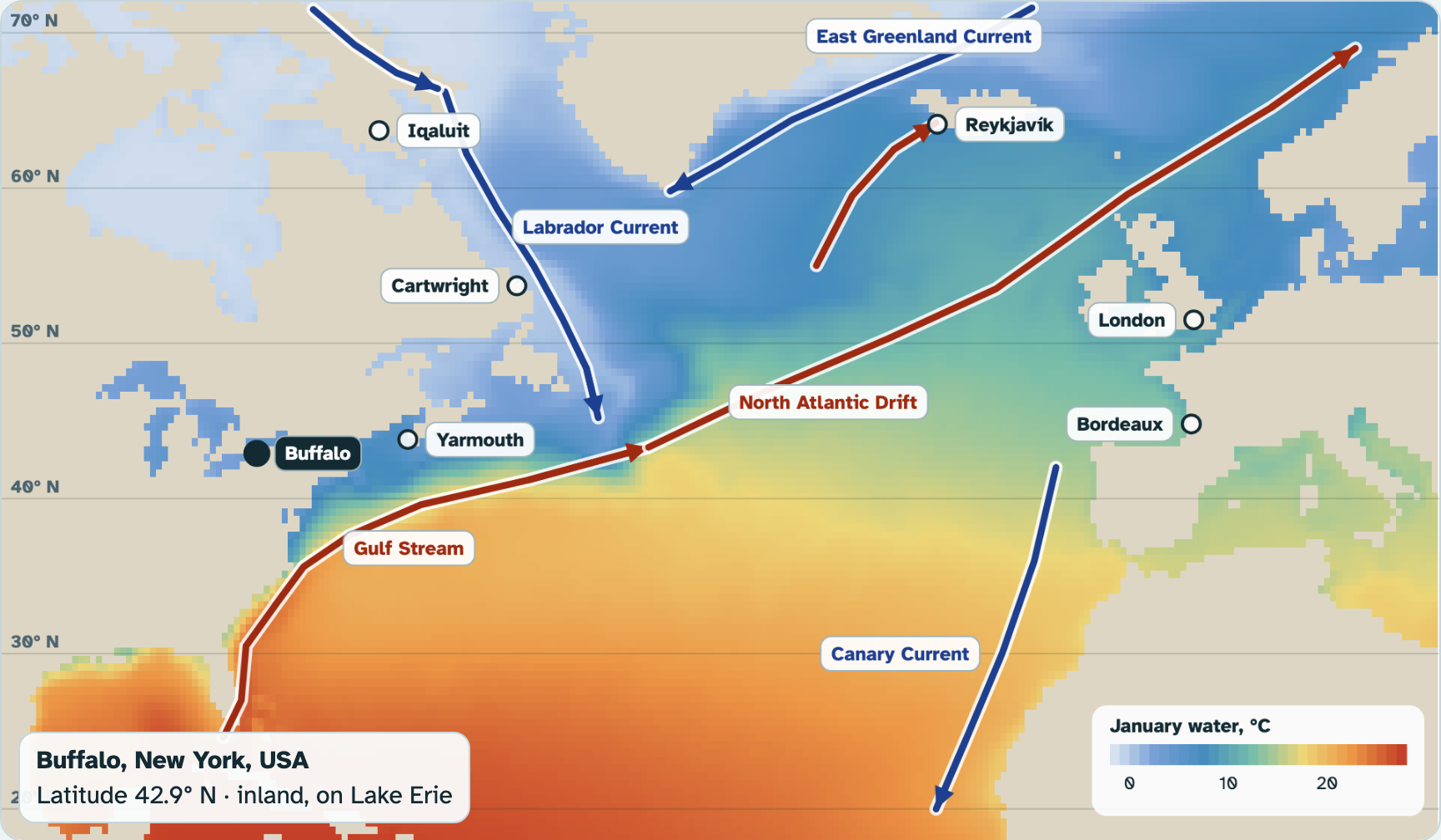
An ocean current is a stream of ocean water that keeps flowing the same way. Warm currents carry warm water away from the equator. Cold currents carry cold water away from the poles. Press Show currents to see them on the map.
Screenshot: mrsajdak.com/currents, Tab 2
PART 2 · LEARN IT · 2 OF 5
The Gulf Stream
The Gulf Stream carries warm water from near Florida up the coast and out across the Atlantic. Past Europe it is called the North Atlantic Drift. It flows at about 6 km per hour on average. That is about 180 cm per second, far faster than the water in your box.
Map: NOAA, public domain
PART 2 · LEARN IT · 3 OF 5
The Labrador Current
The Labrador Current carries cold water down from the Arctic, past Cartwright and the coast of Canada. So London and Cartwright get about the same sunlight, but one coast gets warm water and the other gets icy water. Air over the water takes on its temperature, and the wind carries that air over the land.
Photo: Jeff Schmaltz, NASA MODIS, public domain
PART 2 · LEARN IT · 4 OF 5
Latitude is not the whole story
Farther from the equator usually means colder. But at the same latitude, a coast with a warm current can be 30 to 50°F warmer in January than a coast with a cold current.
Photo: No Swan So Fine, CC BY-SA 4.0
PART 2 · LEARN IT · 5 OF 5
The ocean conveyor belt
Near the North Pole, the water gets very cold and salty. It sinks, like your blue water, and slides along the deep ocean floor around the world. Warm water flows in at the top to take its place. Scientists call this loop the ocean conveyor belt. One trip takes about 1,000 years. If melting ice makes the water fresher, it sinks less, and the loop could slow down.
Photo: USGS, public domain
PART 2 · QUESTIONS 9 TO 11
Currents carry heat
QUESTION 9
Name the currents
Which current flows past London? Past Cartwright?
How can a current in the sea warm or chill the land?
QUESTION 10
Predict Bergen
Bergen, Norway is at 60.4° N. Find it on the map.
Predict its January, then lock it in and check.
QUESTION 11
If the conveyor slowed
Melting ice makes the water near the pole fresher.
What could that change for London’s winters?
TAB 3 · QUESTIONS 12 TO 16
Part 3. Winds on a spinning Earth
Air is a fluid too. It moves in loops.
Real winds, measured from space.
Photo: NASA Goddard, CC BY 2.0
PART 3 · TAB 3
Record the winds
1
Press 15° N. Press Record.
2
Do the same for 30° N, 43° N Buffalo and 66° N.
3
Press Model: no spin. Then Model: Earth spins.
4
Compare each model with Real winds.
PART 3 · QUESTIONS 12 AND 13
Real winds and two models
Model: no spin.
Model: Earth spins.
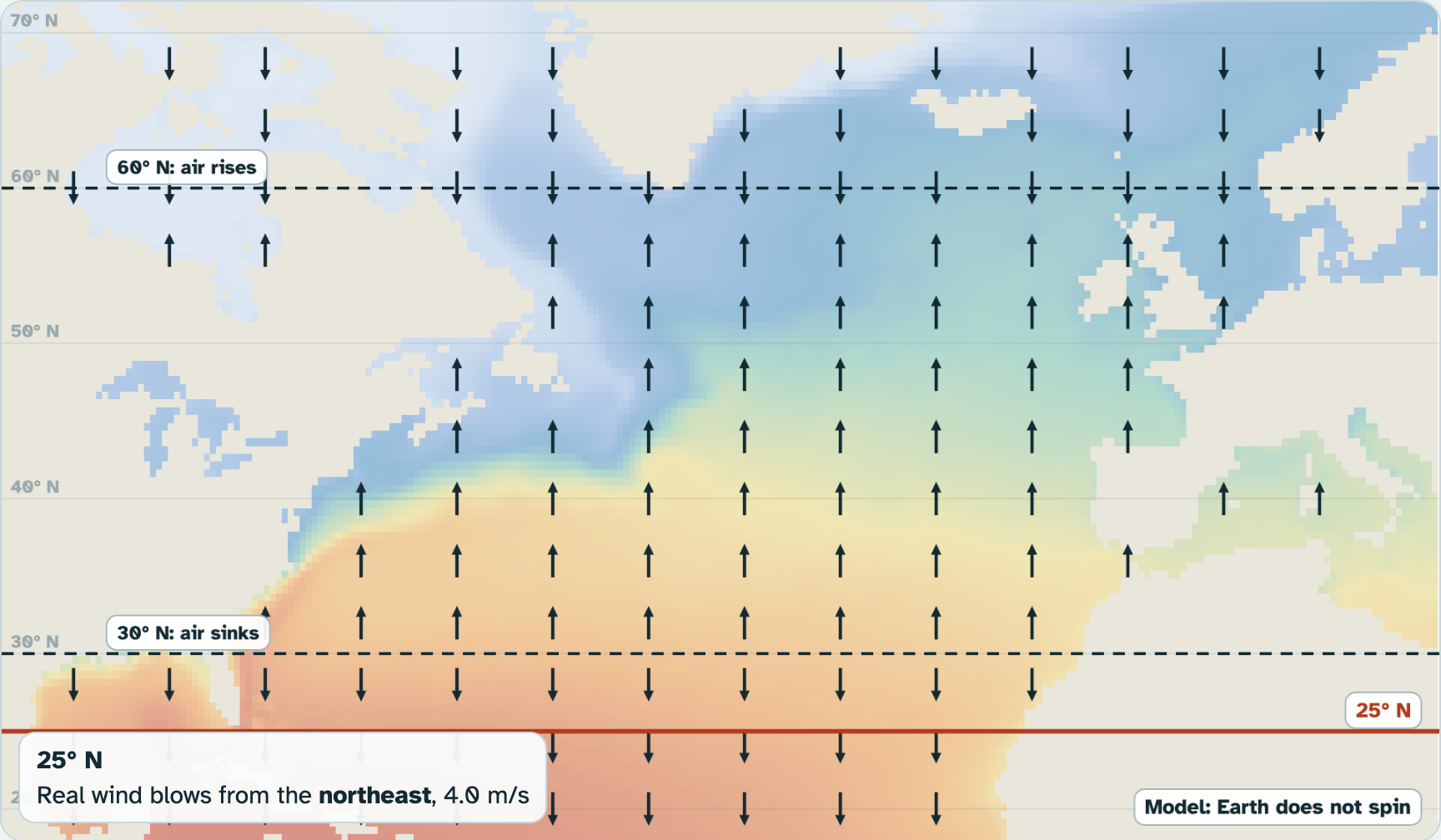
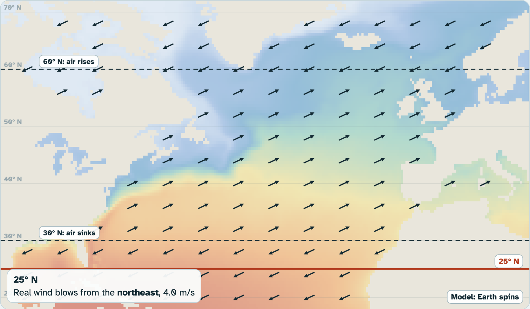
Fill in Question 12 from Your records. Then Question 13: which model looks more like the real winds?
Screenshot: mrsajdak.com/currents, Tab 3
PART 3 · LEARN IT · 1 OF 5
Air makes loops too
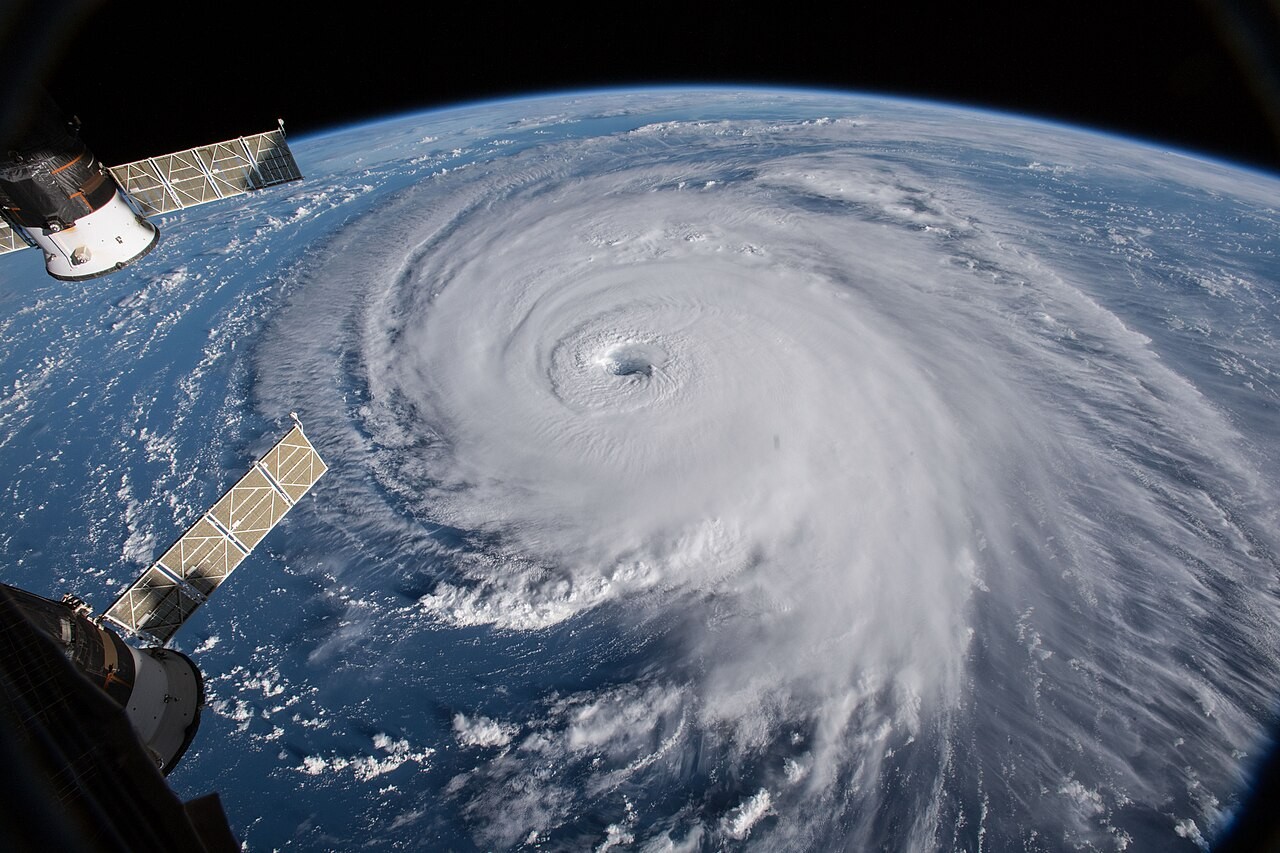
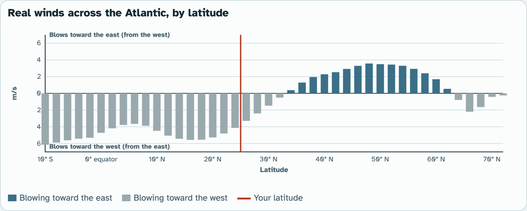
Air is a fluid, like water. The sun heats the equator most. Warm air there rises, cools and drops its rain. It flows toward the poles high up, sinks near 30° N, and flows back to the equator near the ground. This loop of air is called a Hadley cell, after George Hadley, who described it in 1735. Two more loops sit between 30° and 60°, and between 60° and the pole.
Screenshot: mrsajdak.com/currents, Tab 3
PART 3 · LEARN IT · 2 OF 5
Where air sinks, winds are weak
Near 30° N the air is sinking, not blowing sideways. That is why the real winds there were the weakest you measured. Sinking air is dry air. Many of the world's deserts sit near 30°.
Screenshot: mrsajdak.com/currents, Tab 3
PART 3 · LEARN IT · 3 OF 5
The Coriolis effect
Earth spins. Air that moves a long way across Earth turns while the ground turns under it. In the north half of Earth, moving air bends to the right. This bending is called the Coriolis effect.
Photo: NASA Goddard, CC BY 2.0
PART 3 · LEARN IT · 4 OF 5
Prevailing winds
A prevailing wind is the wind that blows most often in a place. The bent air that flows back to the equator becomes the trade winds, from the northeast. Between 30° and 60°, the air bends into the westerlies, from the west. Buffalo sits under the westerlies, so most of its weather arrives from the west. Near the pole are the polar easterlies.
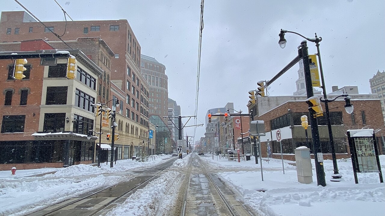
Photo: Andre Carrotflower, CC BY-SA 4.0
PART 3 · LEARN IT · 5 OF 5
Winds push the currents
Wind drags the top of the ocean along. The trade winds push warm water west, toward the Caribbean and the Gulf of Mexico. It piles up and pours out as the Gulf Stream. The westerlies then push it east, toward Europe. Wind, water and heat work together.
Map: NOAA, public domain
PART 3 · QUESTIONS 14 AND 15
Prevailing winds
QUESTION 14
Name the winds
The prevailing wind at 15° N, and at Buffalo.
Use the Coriolis effect to explain why Buffalo’s air comes from the west, not straight from the south.
QUESTION 15
The calm belt, and the model
Why was the wind weakest at 30° N?
Name one thing the three-loop model leaves out.
WRAP IT UP · QUESTION 16
Is it only the latitude?
The claim
“How warm a place is depends only on how far it is from the equator.”
Part 2
Pick one pair of places and their January numbers.
Part 1 or 3
Name one thing that moves heat: convection, a current, or the wind.
Reasoning
Argue against the claim. Say how the heat gets moved.
The Labrador coast in late February, at about London’s latitude.
Photo: Jeff Schmaltz, NASA MODIS, public domain
WRAP IT UP · BACK TO THE START
Revisiting the Phenomenon
Why are some coasts mild and others frozen, at the same distance from the equator?
1Using evidence from today, explain why London’s park is green in January while the Labrador coast is frozen.
2Where did the heat that warms London come from, and what carried it there?
3How does the box model help explain the ocean? What does it leave out?
4Which numbers from your worksheet best support your explanation?
Photo A: London, 51.5° N, in January.
Photo B: the Labrador coast, about 53° N.
Photos: No Swan So Fine, CC BY-SA 4.0 · Jeff Schmaltz, NASA MODIS, public domain
LAST CHECK
Before you hand it in
Name, date and period are on top.
All three tables are full.
Question 10 has your prediction and the real number.
Every claim uses numbers from your own tables.
Photo: Txllxt TxllxT, CC BY-SA 4.0