ENVIRONMENTAL SCIENCE · CHAPTER 6
Shore to Sea Floor
Follow along with your worksheet, one question at a time.
mrsajdak.com/oceanzones
Photo: Hans Hillewaert, CC BY-SA 3.0
START HERE · PICK AN OPENER
Choose how to open the lesson
Click a card to jump to it. Every option ends at the same Observe, Wonder, Predict slide and the same driving question.
OPTION A · VIDEO
Into the Dark
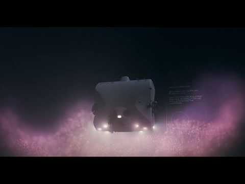
Clip 1 is a research submarine going down into the deep sea near the Seychelles, in the Indian Ocean. Clip 2 is a wave table, a model of a beach, with a mangrove forest in front of the shore.
Watch for
Watch the color of the water as the sub goes down. When does it go dark?
What do you see living in the dark?
In the wave table: what happens to the waves when they reach the trees?
Videos on YouTube: Nekton; Emriver, Inc.; CORPSCONNECTION.
OPTION B · TRY IT · 4 MINUTES
How Deep Does Light Go?
1
Turn the room lights down. Turn on a phone flashlight and lay the phone face up on a desk.
2
Lay one sheet of wax paper or printer paper over the light. Can you still see the bright spot?
3
Add sheets one at a time. Count them out loud.
4
Stop when you can no longer see the light at all. Write down the number of sheets.
You need
One phone with a flashlight
About 20 sheets of wax paper or thin printer paper
The room lights off or down
Watch for
The first few sheets block the most light.
How many sheets until the light is gone?
Plants and algae need light. Where could they grow in a stack like this?
OPTION C · PHOTOS
Phenomenon: Roots and a Storm
Photos: Hans Hillewaert, CC BY-SA 3.0 · NASA, public domain
START HERE
Observe, wonder, predict
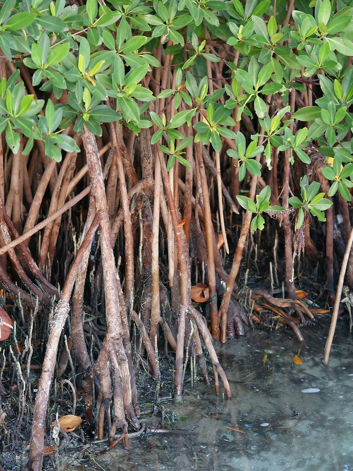
These trees grow along warm coasts, standing in salt water on roots like stilts. A big storm is coming. Behind the trees are towns, and in the water are young fish.
OBSERVEWhat do you notice about the roots?
WONDERWhat do you wonder about what lives in and around them?
PREDICTWhen the storm waves reach these trees, what will happen to the waves? Explain your reasoning.
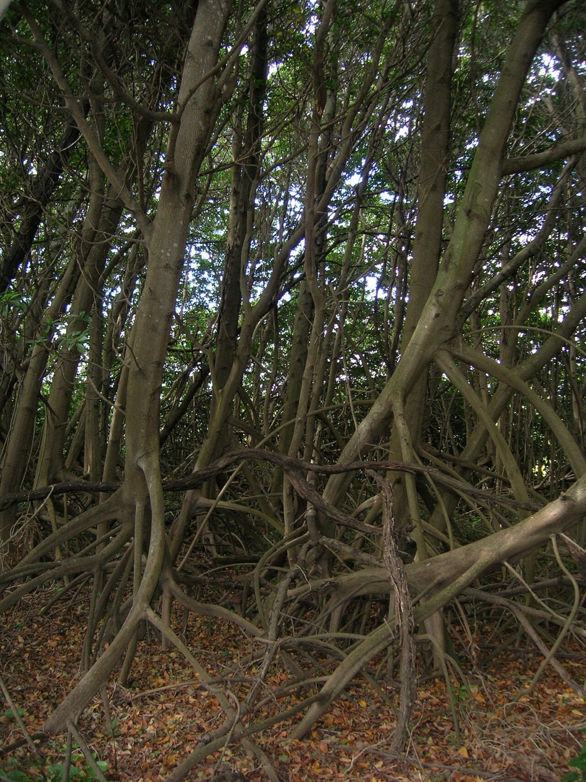
Photo A, up close.
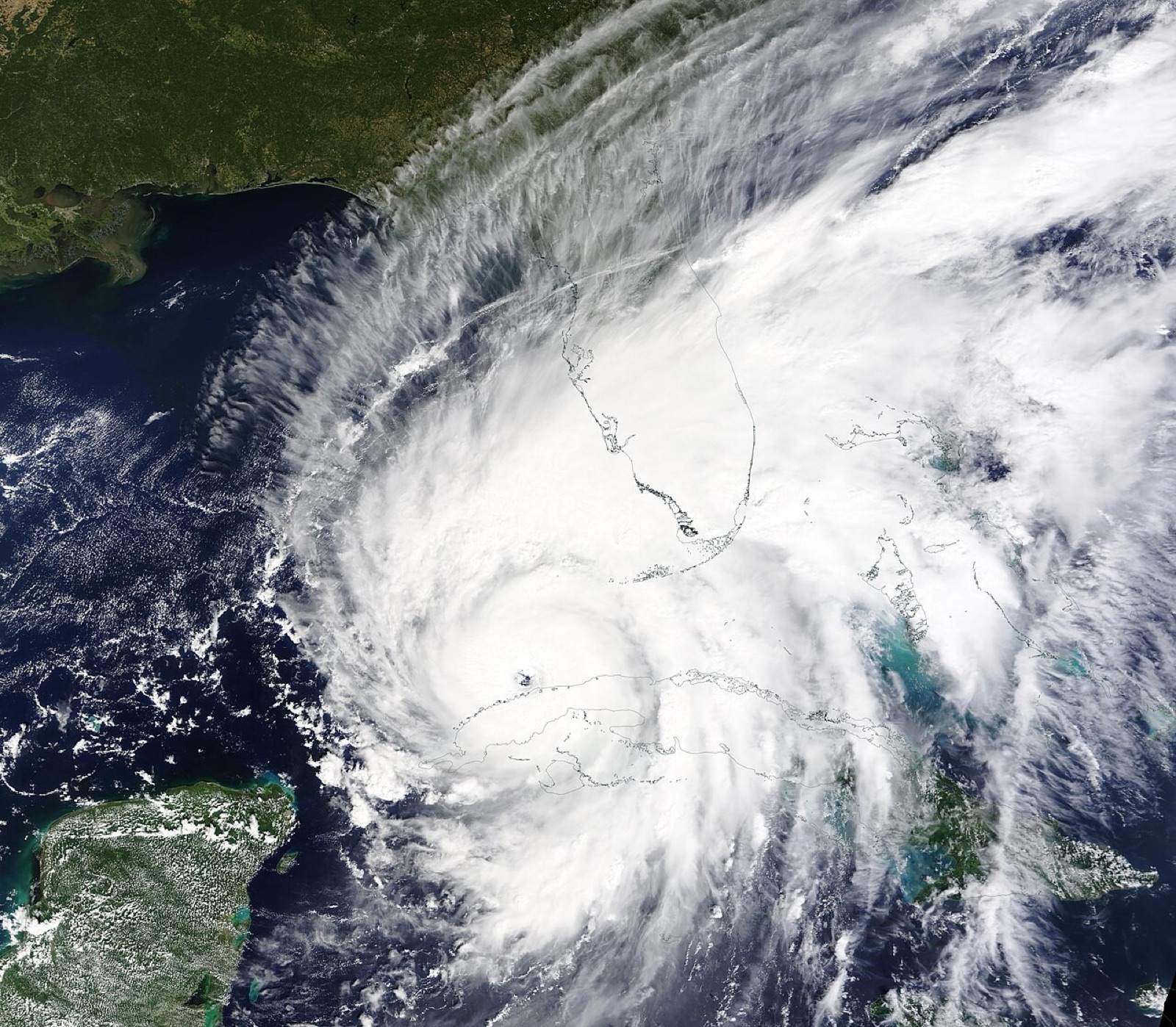
Photo B, from space.
Photos: Hans Hillewaert, CC BY-SA 3.0 · NASA, public domain
DRIVING QUESTION
Where does the ocean’s life live, and what does it do for people?
START HERE
What Happened Here?
Finished observing? Click here to find out.
Photo A is red mangrove trees, standing in shallow salt water on their prop roots. Photo B is Hurricane Ian on September 28, 2022, a few hours before it hit the west coast of Florida, where mangrove forests line much of the shore.
Watched the video or tried it? Click here.
The sub was diving near the Seychelles, in the Indian Ocean. Daylight fades within a few hundred meters, but animals still live in the dark below. The paper stack did the same thing to the flashlight: every layer took some of the light that was left.
Today, you will take a probe 4,700 meters down to the sea floor. You will use a satellite map to find where the ocean's food is made. Then you will send storm waves through a mangrove forest and measure what reaches the houses. At the end, you will return to the driving question.
BEFORE YOU START
Three things you will measure
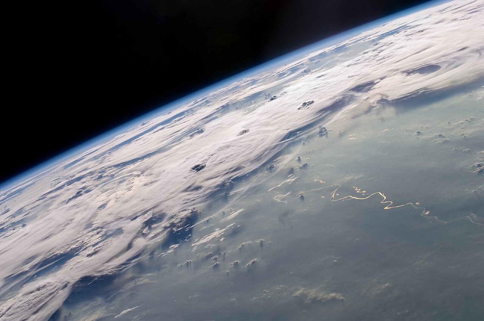
Open ocean, far from any land.
Words for this lab
Light is given as a percent of the light at the surface. 100% is full daylight.
Pressure is in atmospheres (atm). 1 atm is the push of the air on you right now.
Chlorophyll is the green coloring in tiny algae. Satellites can measure it from space.
How deep do you think sunlight goes into the sea?
Photo: NASA Expedition 20 crew, public domain
BEFORE YOU START
What you will learn
I can use real ocean data to describe the open sea's three zones.
I can explain why most ocean life is in the coastal zone.
I can name the services a coastal ecosystem gives people, and use numbers to argue for keeping it.
BEFORE YOU START
Get set up
1
Open mrsajdak.com/oceanzones on your device.
2
Write your name, the date and your period on the worksheet.
3
Find the three tabs at the top of the lab. Each tab goes with one part of the worksheet.
4
Start on Tab 1. Do not skip ahead.

| Tab in the lab | Worksheet | Questions |
|---|---|---|
| 1. Dive down | Part 1 | 1 to 6 |
| 2. Coast or open sea | Part 2 | 7 to 11 |
| 3. Roots against waves | Part 3 and Wrap it up | 12 to 18 |
Screenshot: mrsajdak.com/oceanzones
TAB 1 · QUESTIONS 1 TO 6
Part 1. Dive down
A ship near Hawaii lowers a probe on a cable.
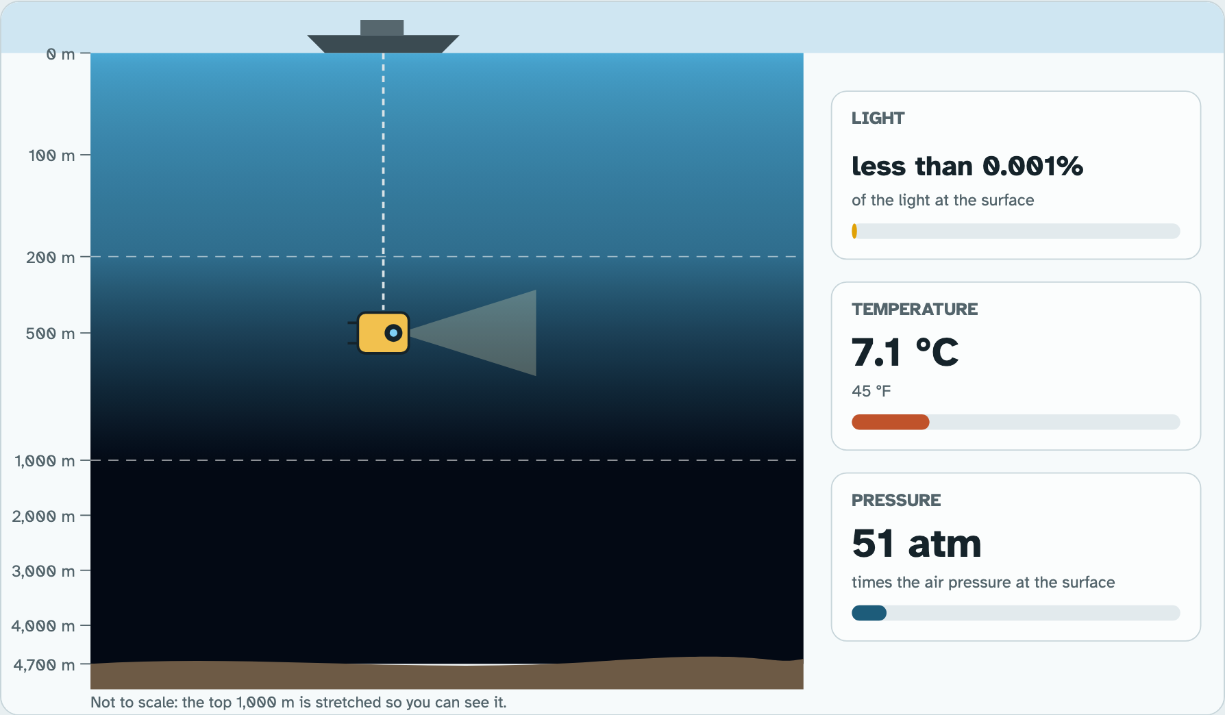
The sea floor is 4,700 meters down. Read the light, the temperature and the pressure on the way.
Photo: NASA Expedition 20 crew, public domain
PART 1 · QUESTIONS 1 TO 3
Take the probe down
1
Pick 0. Press Record.
2
Do the same at 100, 200, 1,000 and 4,000 m.
3
Copy your dive log into Question 1.
4
Answer Questions 2 and 3 from your log.
PART 1 · QUESTION 1
Read the probe
1
The ruler on the left is the depth.
2
The three boxes on the right are the readings.
3
Seen at this depth shows what lives there.
4
The graph under the lab shows every depth at once.
Example
At 50 m, the light is 13%.
That is 13 out of every 100 parts of daylight.
13% of the light
These are not your numbers. Use your own.
Screenshot: mrsajdak.com/oceanzones, Tab 1
PART 1 · LEARN IT · 1 OF 5
The open sea
Far from land, past the edge of the shallow sea floor, is the open sea. It is most of the ocean. Your probe dove into the open sea near Hawaii. Scientists split it into three zones by depth and light.
Photo: NASA Expedition 20 crew, public domain
PART 1 · LEARN IT · 2 OF 5
Euphotic zone: bright
The euphotic zone is the top layer, down to about 200 meters. It is the only zone with enough light for photosynthesis. Tiny drifting algae, called phytoplankton, make food here. You measured it: at 100 meters, only about 2% of the light is left. By 200 meters, almost none.
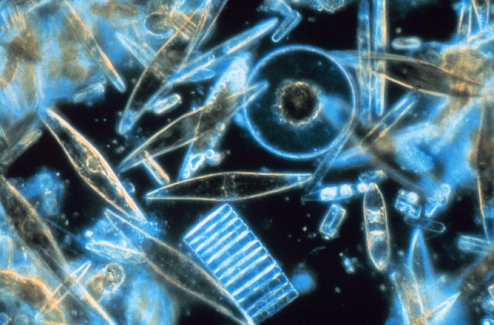
Photo: Prof. Gordon T. Taylor, Stony Brook University, public domain
PART 1 · LEARN IT · 3 OF 5
Bathyal zone: dim
The bathyal zone runs from about 200 to 1,000 meters. A little blue light gets this deep. Animals can see it, but it is too dim for photosynthesis. So no plants or algae grow here. The water gets cold fast.
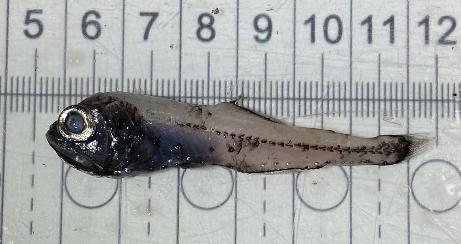
Photo: HulloThere, CC BY 4.0
PART 1 · LEARN IT · 4 OF 5
Abyssal zone: dark
The abyssal zone is below about 1,000 meters, all the way to the sea floor. It is dark and cold, near 1.5°C. The pressure is huge: at 4,000 meters it is about 400 times the pressure at the surface.
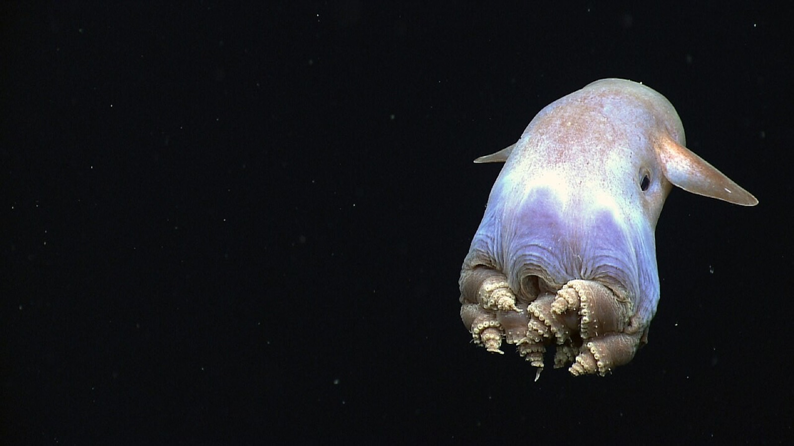
Photo: NOAA Okeanos Explorer, public domain
PART 1 · LEARN IT · 5 OF 5
Food from above
Nothing makes food from sunlight in the dark. So most animals in the abyssal zone eat dead and decaying bits that drift down from the zones above. Some eat each other. Light, temperature, pressure and food decide what can live in each zone.
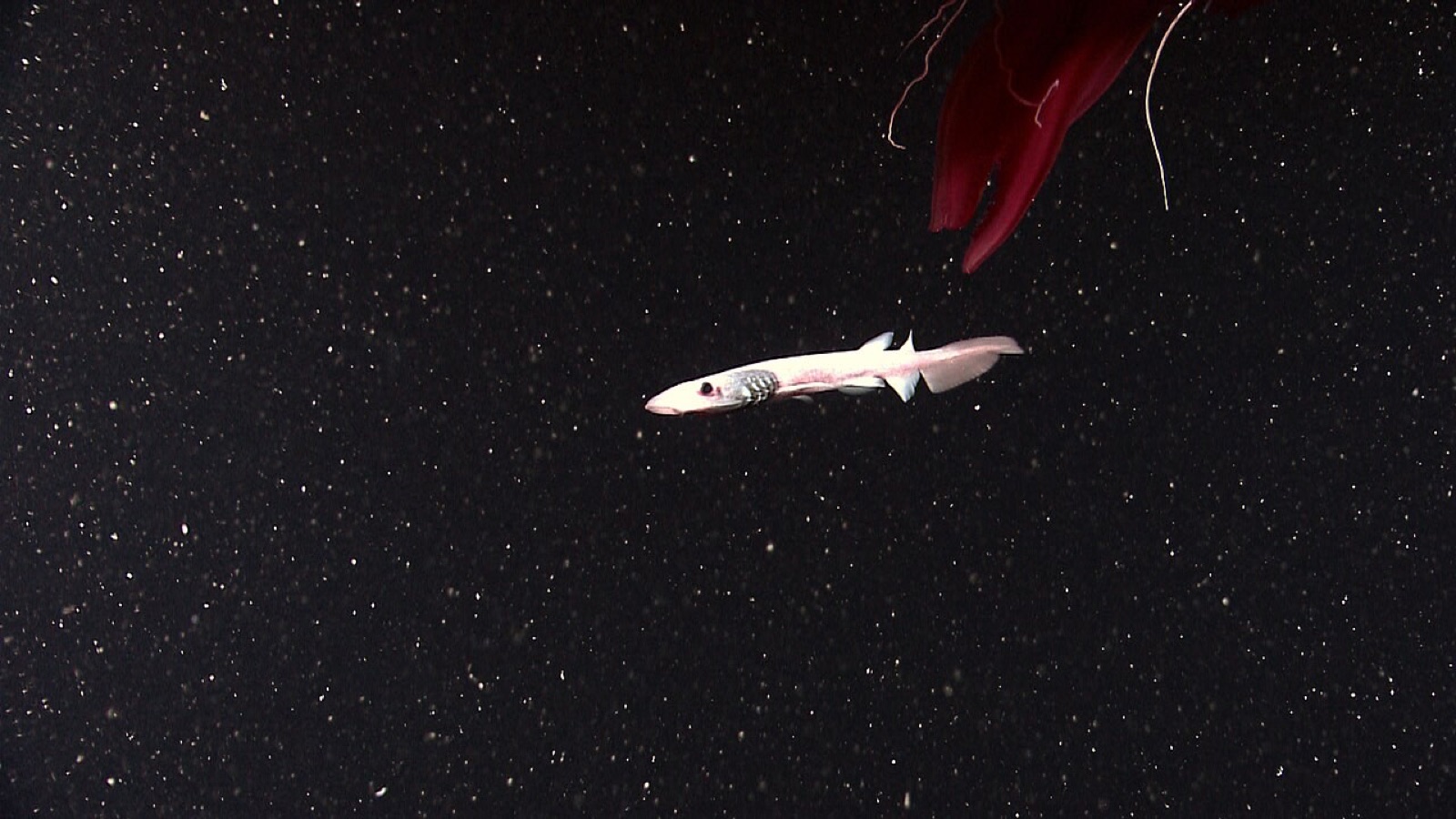
Photo: NOAA Photo Library, public domain
PART 1 · QUESTIONS 4 TO 6
Name the zones
QUESTION 4
Bright · dim · dark
Three zones
Fill in the zone for each.
Which one has enough light for photosynthesis?
QUESTION 5
3 rows
Which zone?
A sea cucumber, phytoplankton, lanternfish.
Tick one zone in each row.
QUESTION 6
4,000 m
Food in the dark
No plants or algae grow there.
Where does the food come from?
TAB 2 · QUESTIONS 7 TO 11
Part 2. Coast or open sea
Where is the ocean’s food made?
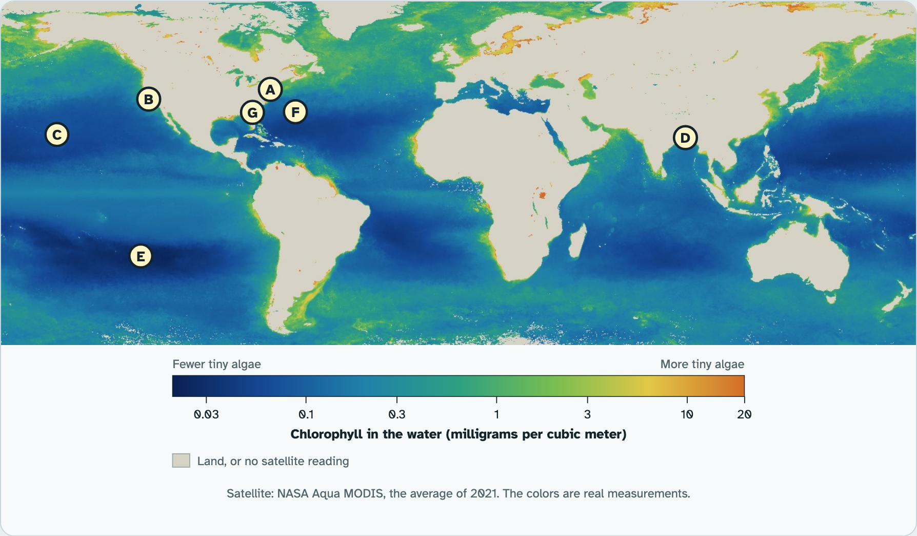
A satellite measured the green in the water for a whole year. Visit seven places.
Photo: Robert Schwemmer, NOAA, public domain
PART 2 · QUESTIONS 7 AND 8
Visit seven sites
1
Tap a letter on the map, or pick it in the list.
2
Copy its chlorophyll and sea floor depth into Question 7.
3
Do all seven, A to G.
4
Press Show the names.
PART 2 · QUESTION 7
Read the map
1
Blue means few tiny algae.
2
Green and yellow mean many.
3
Each letter is one site.
4
Your site log fills in as you go.
Example
6.0 ÷ 0.05 = 120.
So 6.0 is about 120 times as much as 0.05.
120 times
These are not your numbers. Use your own.
Screenshot: mrsajdak.com/oceanzones, Tab 2
PART 2 · LEARN IT · 1 OF 6
Chlorophyll means food
Phytoplankton are green because of chlorophyll. More chlorophyll means more tiny algae making food. They are the bottom of the ocean's food web. Fish, shrimp, whales and seabirds all depend on them.
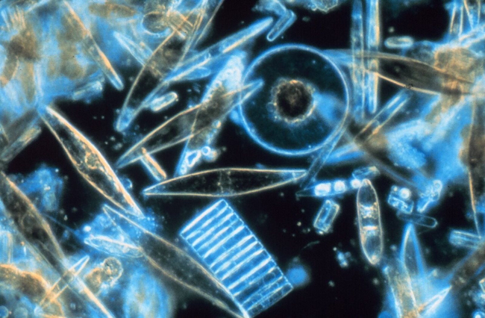
Photo: Prof. Gordon T. Taylor, Stony Brook University, public domain
PART 2 · LEARN IT · 2 OF 6
The coastal zone
The coastal zone is the shallow water from the high-tide line on land out to the edge of the continental shelf, where the sea floor drops off, about 200 meters deep. It is less than a tenth of the ocean. But it holds most of the ocean's kinds of living things.
Photo: Robert Schwemmer, NOAA, public domain
PART 2 · LEARN IT · 3 OF 6
Why the coast is rich
Your four coastal sites had far more chlorophyll than the open sea. The water is shallow, so sunlight reaches much of it. Rivers wash in nutrients from the land, like fertilizer. In the open sea, the water is clear because it has few nutrients and few algae.
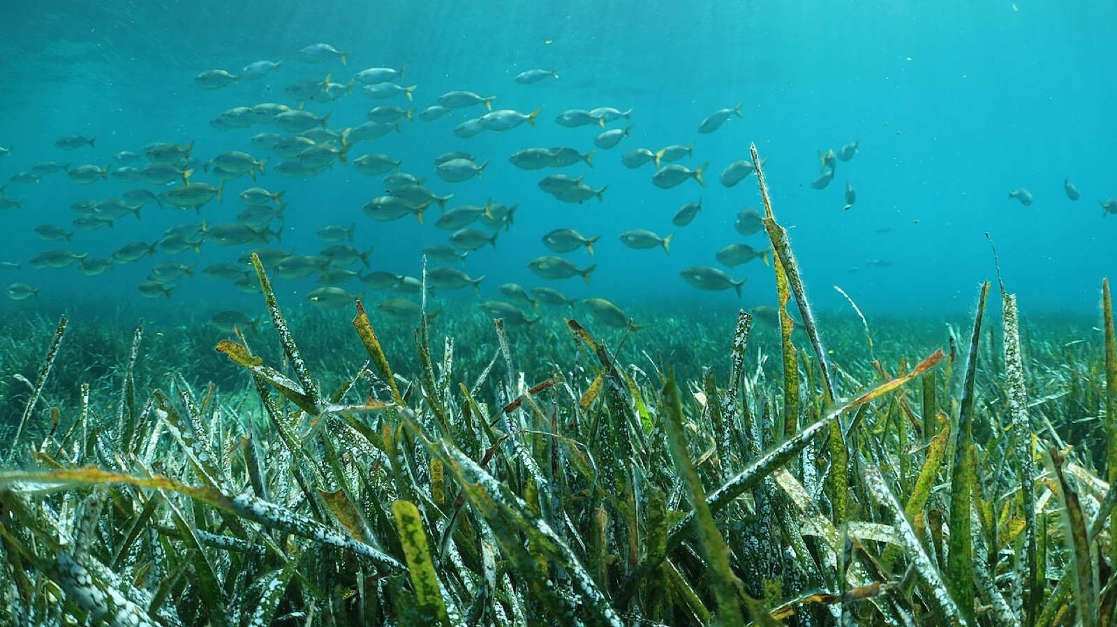
Photo: Karim saari, CC BY 4.0
PART 2 · LEARN IT · 4 OF 6
Estuary
An estuary is where a river meets the sea. Fresh water and salt water mix there into brackish water. New York's Hudson River is an estuary. Ocean tides push salt water up it about 150 miles, all the way to Troy.
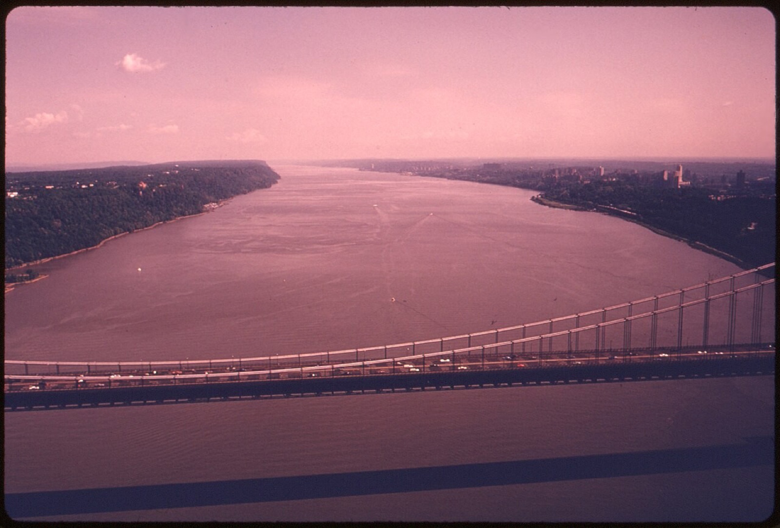
Photo: Hope Alexander, public domain
PART 2 · LEARN IT · 5 OF 6
Coastal wetland
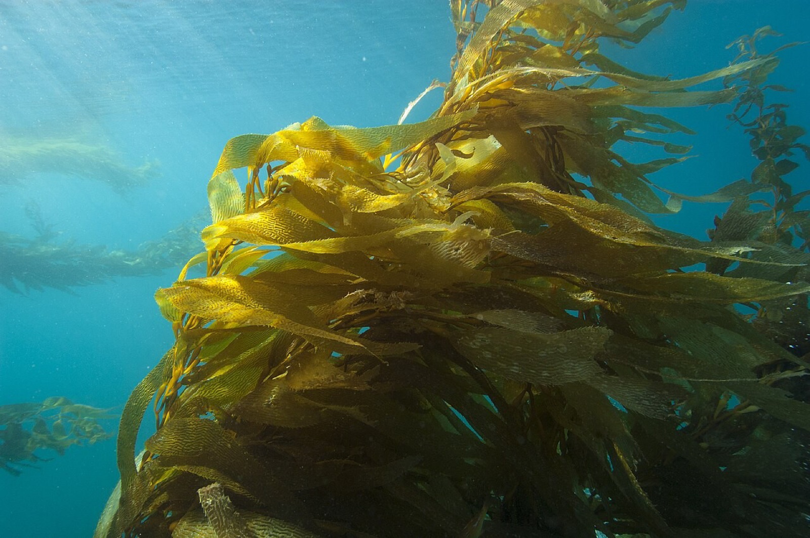
A coastal wetland is land covered by salt water all or part of the year. Salt marshes grow on cooler coasts. Mangrove forests grow on warm, tropical coasts. A kelp forest is giant seaweed that grows on cold, rocky coasts. All of these are in the coastal zone.
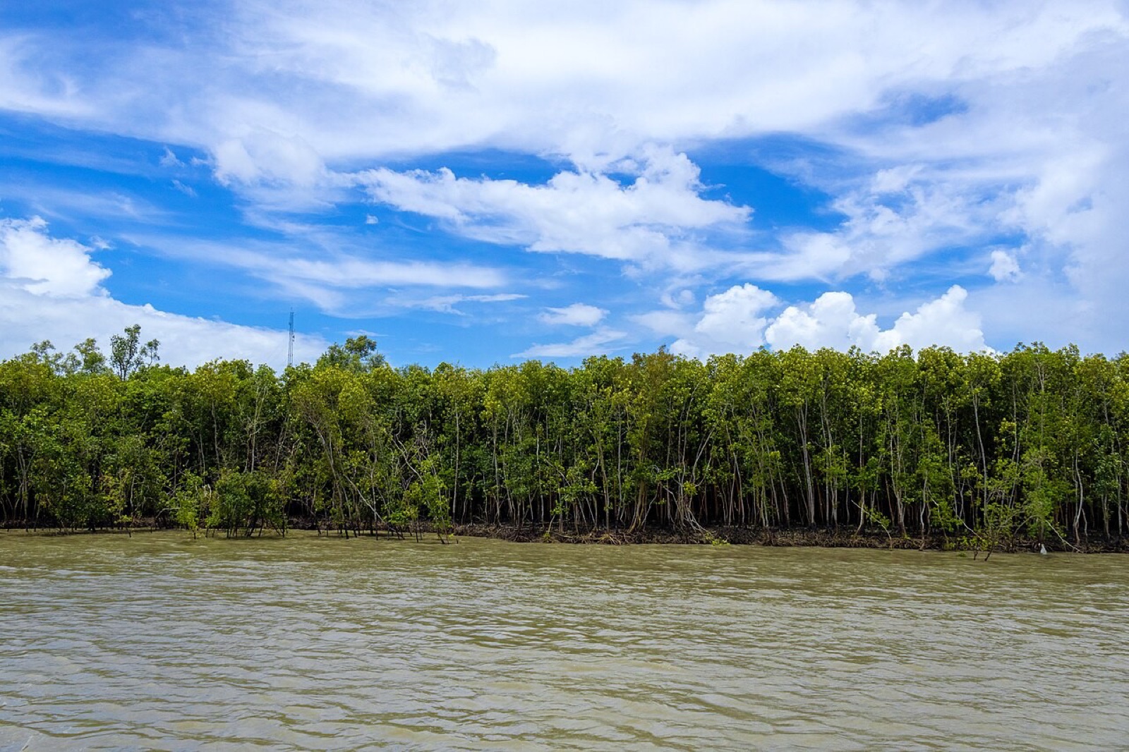
Photo: Kingshuk Mondal, CC BY 4.0
PART 2 · LEARN IT · 6 OF 6
Ecosystem services
An ecosystem service is something nature does for people, for free. Coastal ecosystems are nurseries where young fish and shrimp grow up. They filter dirt and extra nutrients out of the water. They slow storm waves and hold the shore in place. They give food, jobs and places to visit.
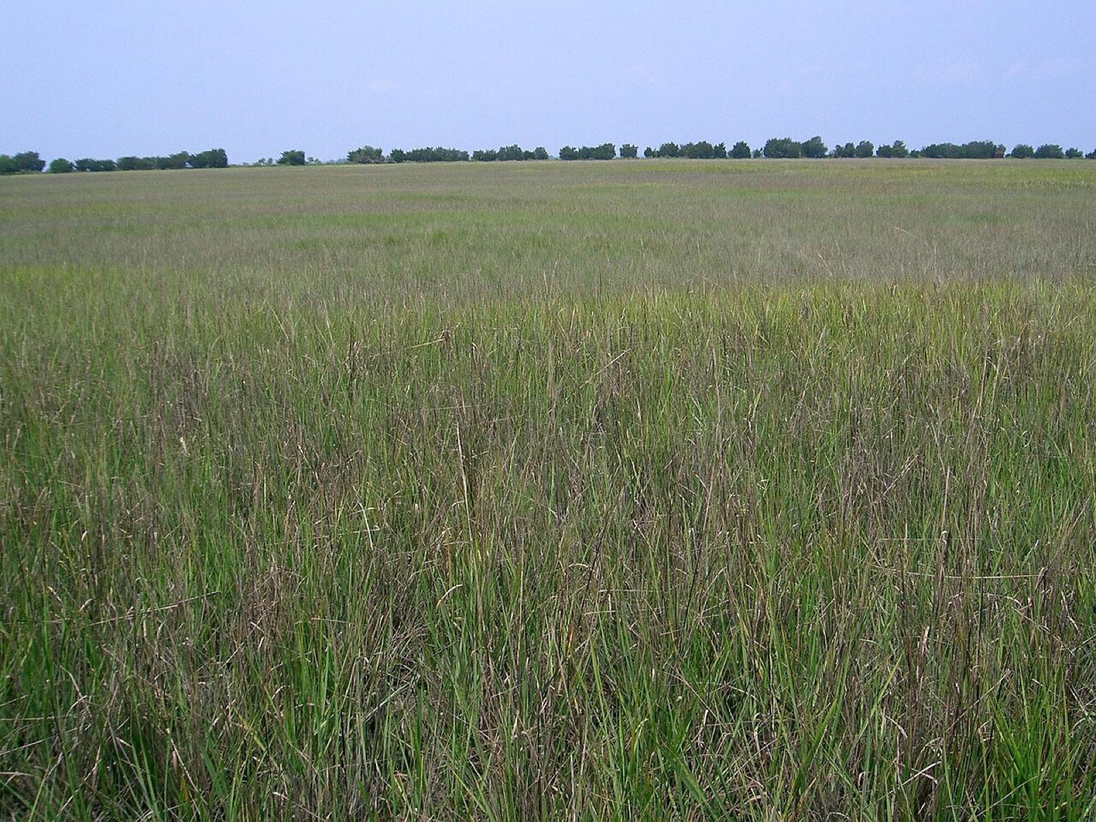
Photo: Graham D. Schuster, CC BY-SA 3.0
PART 2 · QUESTIONS 9 TO 11
Why the coast, and what it does
QUESTION 9
Shelf
The coastal zone
Where does it end?
Two reasons it has more algae.
QUESTION 10
5 sites
Which ecosystem?
Estuary, coastal wetland, kelp forest or open sea.
Tick one in each row.
QUESTION 11
Services
For people
Brackish water is a mix of what?
Name two services.
TAB 3 · QUESTIONS 12 TO 18
Part 3. Roots against waves
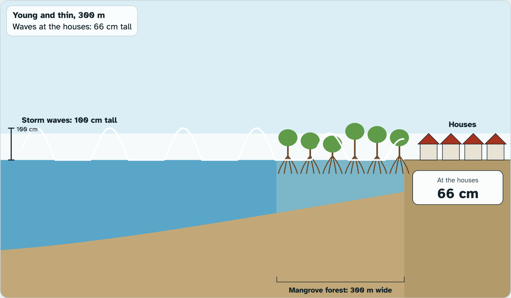
A storm sends 100 cm waves at a warm coast.
How much of each wave gets through the mangroves to the houses?
Photo: Forest and Kim Starr, CC BY 3.0
PART 3 · QUESTIONS 12 AND 13
Send the storm waves
1
Pick Young and thin.
2
Set the width to 0. Press Send the storm waves.
3
Do the same at 100, 200 and 500 m.
4
Then pick Old and dense and do all four again.
PART 3 · QUESTIONS 13 AND 14
Read the run, then the math
1
The box by the houses shows the wave that got through.
2
The graph shows the wave shrinking through the forest.
3
Percent smaller = (100 − at the houses) ÷ 100 × 100.
Example
Waves reach the houses at 40 cm.
(100 − 40) ÷ 100 × 100
= 60% smaller
These are not your numbers. Use your own.
Screenshot: mrsajdak.com/oceanzones, Tab 3
PART 3 · LEARN IT · 1 OF 5
Built to slow water
Mangroves stand on many thin, curved roots, like stilts. A wave has to push past thousands of them. Each root takes a little of the wave's energy. So the wave gets smaller the farther it goes into the forest. This is structure and function: the shape of the forest is what does the job.
Photo: Forest and Kim Starr, CC BY 3.0
PART 3 · LEARN IT · 2 OF 5
The front edge does the most
Look at your runs. The first 100 meters of forest cut the wave the most. A dense, old forest cuts it much more than a young, thin one. Scientists measured real forests: 100 meters of mangroves can cut wave height by about 13% to 66%.
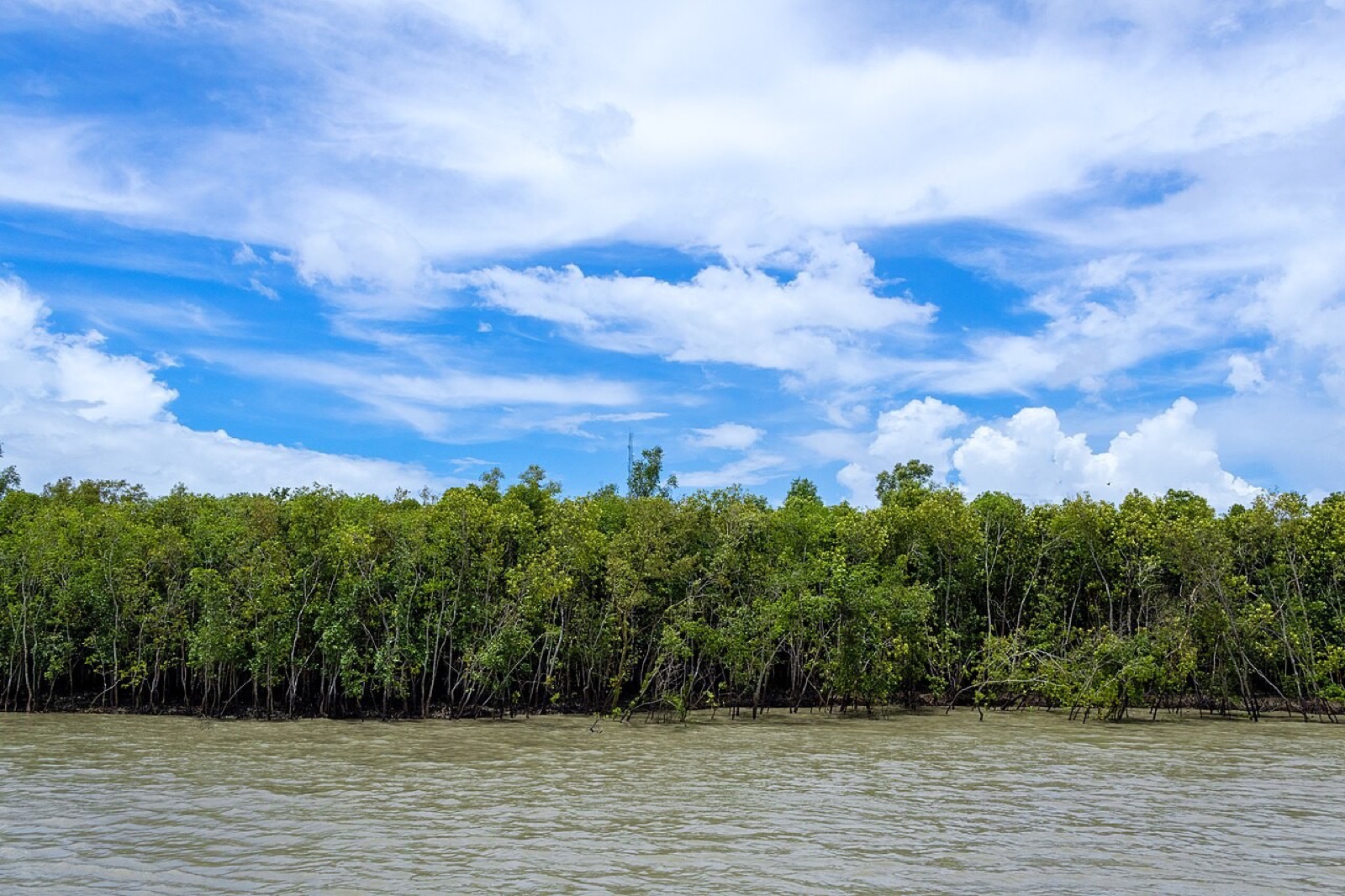
Photo: Kingshuk Mondal, CC BY 4.0
PART 3 · LEARN IT · 3 OF 5
A service worth billions
Protecting the shore is an ecosystem service. When Hurricane Ian hit Florida in 2022, scientists estimate the mangroves cut flood damage to homes and buildings by about $4.1 billion.
Photo: NASA, public domain
PART 3 · LEARN IT · 4 OF 5
More than a wall
Mangroves give other services too. Young fish, crabs and shrimp hide in the roots until they grow up. The roots trap mud, so the water stays clean and the shore builds up. Mangrove mud stores a lot of carbon. A seawall can block waves, but it does none of these other jobs, and it has to be repaired.
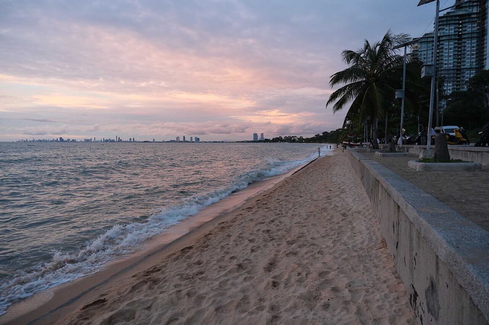
Photo: PattayaPatrol, CC BY-SA 4.0
PART 3 · LEARN IT · 5 OF 5
What is lost
When a coast loses its mangroves, the change lasts. The shore wears away a little more with every storm. Waves reach the houses taller. The young fish have nowhere to grow, so there are fewer fish to catch.
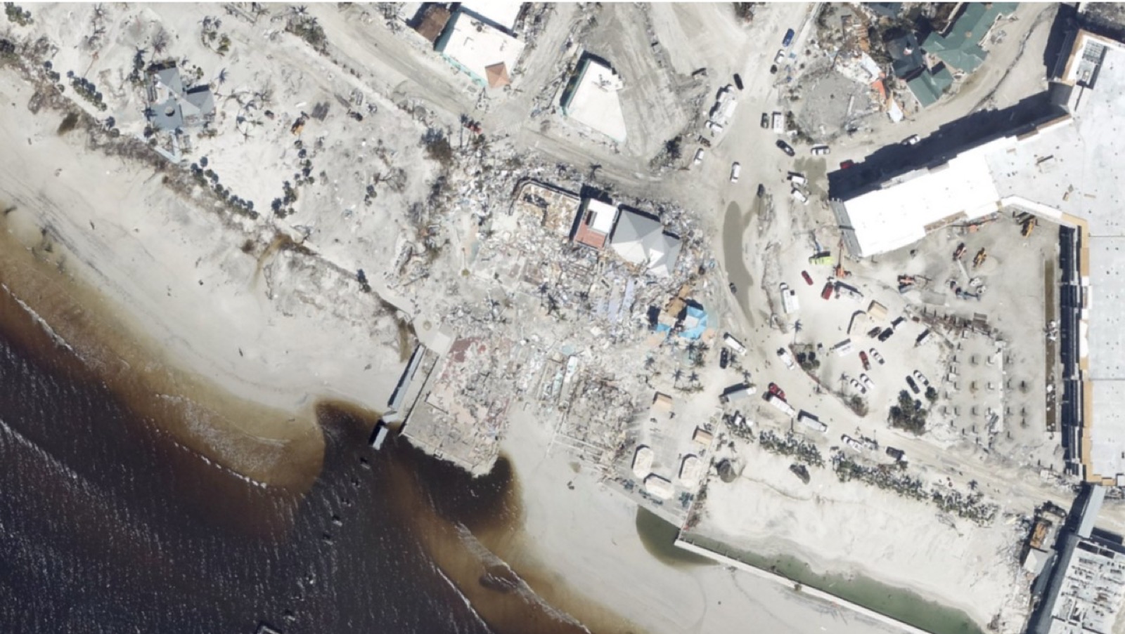
Photo: NOAA, public domain
PART 3 · QUESTIONS 15 TO 17
Built to slow water
QUESTION 15
Roots
How it works
Thin roots each take some of the wave’s ___.
So the wave gets ___.
QUESTION 16
Model
What it leaves out
This lab is a model.
Name one thing about a real coast or storm it leaves out.
QUESTION 17
+2
More services
Besides slowing waves,
name two more things mangroves do.
WRAP IT UP · QUESTION 18
A seawall instead?
The claim
“Clear 200 m of old, dense mangroves and build houses with an ocean view. A seawall will do the same job.”
Evidence
Two numbers from this lab.
A service
One thing the mangroves do that a wall cannot.
Reasoning
Agree or disagree, and say why your evidence supports it.
A seawall along a beach.
Photo: PattayaPatrol, CC BY-SA 4.0
WRAP IT UP · BACK TO THE START
Revisiting the Phenomenon
Where does the ocean’s life live, and what does it do for people?
1Using evidence from today, where does most ocean life live, and why there?
2What happened to the storm waves in the mangroves? Use a number.
3What else do the mangroves do for the people behind them?
4What would the town lose if the mangroves were cleared?
Photo A: red mangrove roots.
Photo B: Hurricane Ian, 2022.
Photos: Hans Hillewaert, CC BY-SA 3.0 · NASA, public domain
LAST CHECK
Before you hand it in
Name, date and period are on top.
Every table is full.
Questions 5, 10 and 12 have one tick in each row.
Question 18 uses two numbers from the lab.
Photo: Kingshuk Mondal, CC BY 4.0